

Domeng to weaken further after exiting PAR — PAGASA
Typhoon Domeng is expected to continue weakening after exiting the Philippine Area of Responsibility (PAR) on Monday, the state weather bureau PAGASA said.
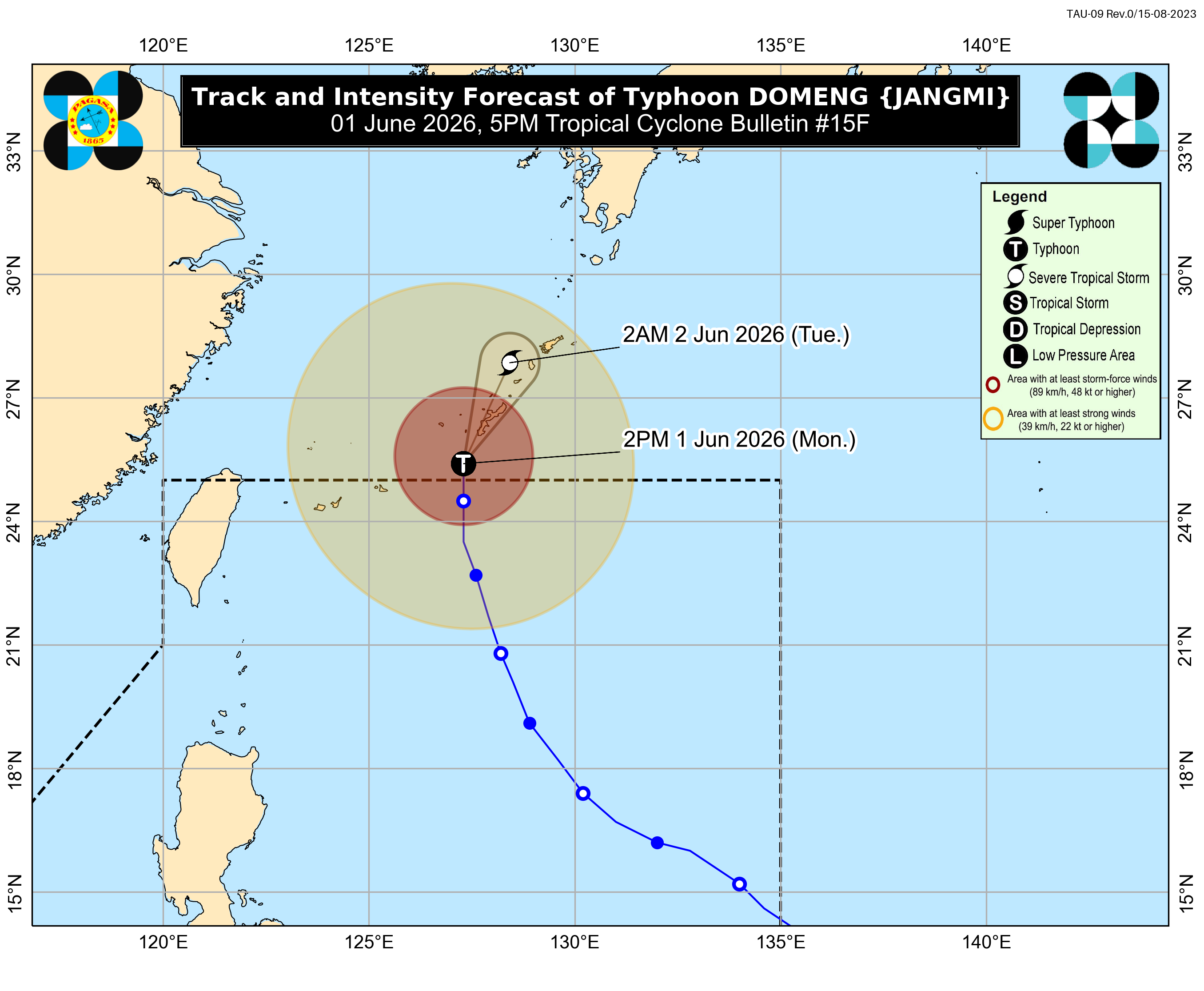
In its 5 p.m. bulletin, PAGASA said the center of the typhoon was last located 795 kilometers northeast of Itbayat, Batanes.
“A steady weakening trend is expected for Domeng as it moves toward increasingly less favorable environmental conditions,” PAGASA said.
Domeng had maximum sustained winds of 120 kilometers per hour near the center and gustiness of up to 150 kilometers per hour, moving northward at 15 kilometers per hour.
While Domeng has exited PAR, PAGASA said heavy rainfall and strong winds may still be experienced in areas outside the forecast confidence cone.
The typhoon is expected to continue moving north-northeastward toward southern Japan.
Meanwhile, the Southwest Monsoon or Habagat is forecast to affect Central Luzon, Southern Luzon, and the western Visayas on Tuesday, according to PAGASA’s 24-hour weather forecast issued at 4 p.m.
Occasional rains are expected over Zambales, Bataan, Cavite, Batangas, and Occidental Mindoro.
Cloudy skies with scattered rains and thunderstorms are also forecast over Metro Manila, the Ilocos Region, Bicol Region, Western Visayas, the rest of Central Luzon, Calabarzon, and Mimaropa.
Localized thunderstorms may bring partly cloudy to cloudy skies with isolated rainshowers over the rest of the country.
PAGASA declared the start of the Habagat season last May 30, marking the onset of the rainy season.—MCG, GMA News
