

Super Typhoon Francisco slows down but maintains strength; Signal No. 1 still up
Super Typhoon Francisco (international name: Mekkhala) maintained its strength early Tuesday morning but slowed down over the sea east of Northern Luzon, the state weather bureau said.
In its 5 a.m. tropical cyclone bulletin, PAGASA said Signal No. 1 remains hoisted over the following areas:
- Batanes, and
- The northeastern portion of Cagayan (Gonzaga, Santa Ana) including the eastern portion of Babuyan Islands (Babuyan Is., Didicas Is., Camiguin Is.,)
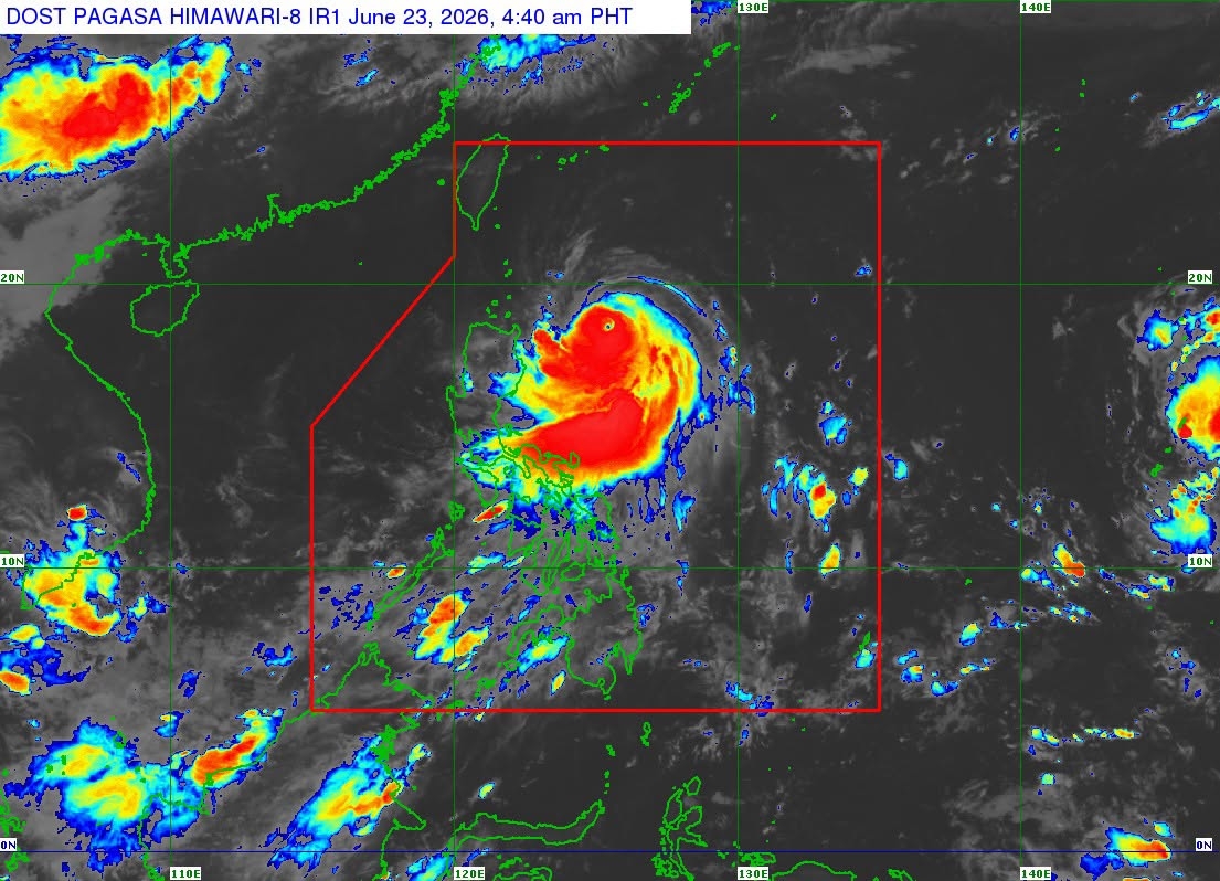
As of 4 a.m., the center of the eye of the super typhoon was estimated to be 410 km east of Aparri, Cagayan.
It is packing maximum sustained winds of 185 km/h near the center, with gustiness of up to 230 km/h, and central pressure of 940 hPa.
Super Typhoon Francisco is moving west northwestward at 10 km/h, with its strong to typhoon-force winds extending outwards up to 360 km from the center.
The state weather bureau said the likelihood of Signal No. 2 being hoisted over some parts of Babuyan Islands and Batanes is “becoming less likely as Francisco is now moving a more northwestward track.”
The super typhoon will also remain far from the Philippine landmass and is forecast to gradually decelerate while moving generally north northwestward until Wednesday, June 24 before recurving towards the Ryukyu Islands in southern Japan.
Super Typhoon Francisco is expected to exit the Philippine Area of Responsibility (PAR) on Friday morning, June 26.
“Francisco may still further intensify or maintain its strength until this afternoon. Afterwards, a weakening trend is expected due to increasingly unfavorable environmental conditions,” PAGASA added.
Meanwhile, the Southwest Monsoon and the periphery of the super typhoon will bring strong to gale-force gusts over the following areas on Tuesday:
- Most of Luzon
- Visayas
- Zamboanga Peninsula
- Northern Mindanao
- Surigao del Norte
- Dinagat Islands
- Davao Occidental, and
- Davao Oriental.
Rough seas are expected over the the eastern seaboards of Batanes and Babuyan Islands (up to 4 meters), the northeastern seaboard of mainland Cagayan (up to 3.5 meters), the remaining seaboards of Batanes and Cagayan, and the eastern seaboards of Isabela and northern Aurora (up to 3 meters).
PAGASA warned mariners of small seacrafts, including all types of motorbancas, not to venture out to sea under these conditions, especially if inexperienced or operating ill-equipped vessels. — JMA, GMA News
