

Typhoon Francisco weakens further; Batanes, northeastern portion of Cagayan under Signal no. 1
Typhoon Francisco further weakened but some areas remain under Wind Signal No. 1 as it maintains a northward track over the Philippine Sea.
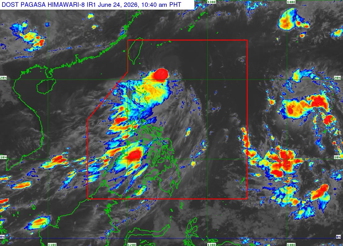
In its 11 a.m. advisory, PAGASA said minimal to minor impacts from strong winds are possible within any of the areas under Wind Signal No. 1 which are, Batanes and the northeastern portion of Cagayan (Gonzaga, Santa Ana) including Babuyan Islands.
Meanwhile, the Southwest Monsoon and the periphery of Typhoon Francisco are expected to bring strong to gale-force gusts over the following areas on Wednesday (especially in coastal and upland areas exposed to winds):
Most of Luzon, Visayas, Misamis Occidental, Lanao del Norte, Camiguin, Dinagat Islands, Davao Occidental, and Davao Oriental.
PAGASA said that heavy rainfall and severe winds may still be experienced in localities outside the forecast confidence cone.
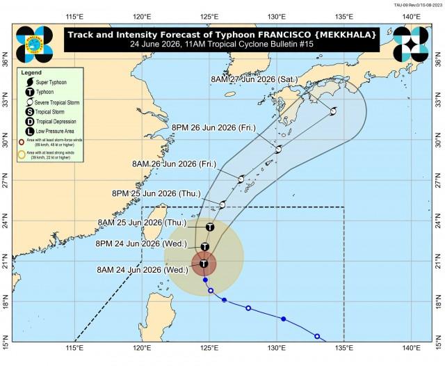
The state weather bureau said Typhoon Francisco will continue moving northward until Thursday, June 25, before turning north northeastward towards the Ryukyu Islands and sea south of mainland Japan.
“On the track forecast, FRANCISCO will exit the Philippine Area of Responsibility (PAR) by Thursday (25 June) evening. FRANCISCO is forecast to gradually weaken throughout the forecast period. Nevertheless, it will likely remain a typhoon while inside the PAR region,” PAGASA said.
The center of Typhoon Francisco was estimated based on all available data at 295 km east Northeast of Basco, Batanes (21.2 °N, 124.7 °E )
Moving westward, it has maximum sustained winds of 140 km/h near the center and gustiness of up to 170 km/h. —VAL, GMA News
