

 GMA Brandtalk
 Tracking
 Archives

Easterlies to bring rains over eastern parts of Northern and Central Luzon
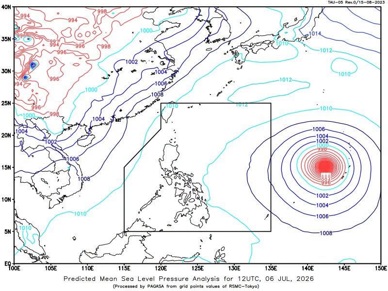
The easterlies are forecast to affect the eastern sections of Northern and Central Luzon on July 7, 2026, the state weather bureau said Monday.
In its 4 p.m. weather bulletin, PAGASA said the easterlies are expected to bring partly cloudy to cloudy skies with isolated rainshowers or thunderstorms over Cagayan Valley and Aurora.
Meanwhile, due to localized thunderstorms, Metro Manila and the rest of the country are forecast to experience partly cloudy to cloudy skies with isolated rainshowers or thunderstorms.
PAGASA advised affected areas of the easterlies and localized thunderstorms for possible flash floods or landslides.
As of 3 p.m., Super Typhoon Bavi is still outside the Philippine Area of Responsibility (PAR) estimated at 2,120 km east of Southeastern Luzon with maximum sustained winds of 205 kmh and gusts up to 250 kmh.
Sea, wind conditions
Light to moderate winds and slight to moderate coastal waters with waves running from 0.6 meters to 2.1 meters are expected in Mindanao, Visayas, Southern Luzon, and the eastern sections of Central Luzon.
Light to moderate winds and slight to moderate coastal waters are expected in the rest of the country, with waves running from 0.6 meters to 1.5 meters in Northern Luzon, and 0.6 meters to 1.2 meters in the rest of the country.
At the PAGASA Science Garden weather station in Diliman, Quezon City, the highest temperature recorded on Monday reached 34.1 degrees Celsius at 2 p.m., while the lowest temperature was logged at 25.4 degrees Celsius at 6 a.m.
Sunrise in Metro Manila on Tuesday is at 5:32 a.m. —Lyjah Tiffany Bonzo/RF, GMA News

