

 GMA Brandtalk
 Tracking
 Archives

Super Typhoon Bavi slows slightly outside PAR
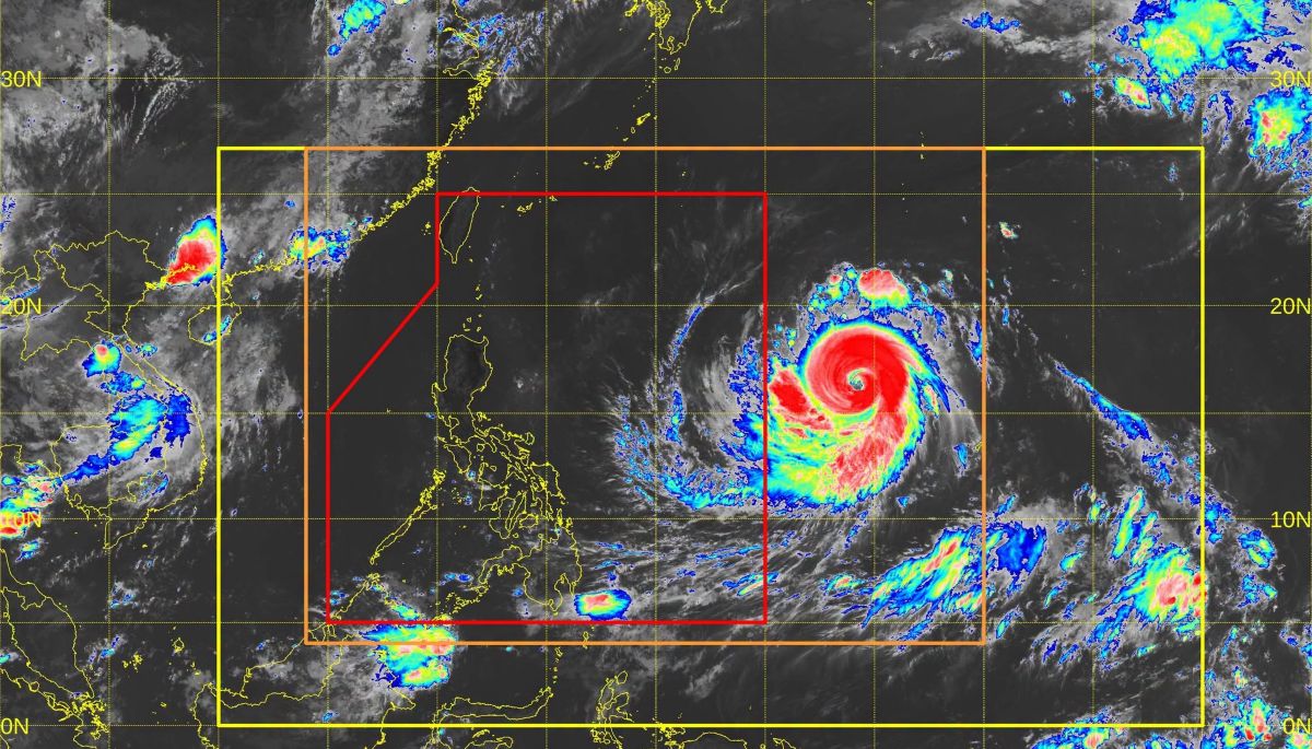
Super Typhoon Bavi slightly weakened and slowed as it moved over the Pacific Ocean outside the Philippine Area of Responsibility (PAR), the state weather bureau PAGASA said Tuesday morning.
As of 10 a.m., Bavi was located 1,845 kilometers east of Central Luzon, packing maximum sustained winds of 185 km/h near the center—down from 195 km/h at 3 a.m.—and gusts of up to 230 km/h. It was moving west northwestward at 20 km/h, slower than the 30 km/h recorded seven hours earlier.
"While over the Philippine Sea, it will move generally northwestward toward the Ryukyu Islands. This tropical cyclone is forecast to maintain its strength as a super typhoon as it enters PAR," PAGASA said in its 11 a.m. advisory.
"Gradual weakening is expected as it moves near Extreme Northern Luzon while approaching eastern Taiwan," the weather bureau said.
Bavi is expected to enter PAR between Tuesday night and early Wednesday morning, when it will be assigned the local name Inday.
PAGASA said Tropical Cyclone Wind Signals (TCWS) No. 2 and No. 3 may be hoisted over the northern and eastern portions of Northern Luzon during Bavi's passage.
"Due to the uncertainty in terms of radius of strong winds, the possibility of raising wind signals over the eastern portions of Southern Luzon and Visayas is not ruled out," PAGASA said.
The enhanced Southwest Monsoon, or Habagat, together with Bavi's outer circulation, will bring strong to gale-force wind gusts, particularly in exposed coastal and upland areas, over the following areas:
Tuesday: Most of Mindanao
Wednesday: Pangasinan, Zambales, Bataan, Cavite, Batangas, most of MIMAROPA, most of the Bicol Region, most of the Visayas, and most of Mindanao
Thursday: Most of the country
PAGASA also forecast heavy rainfall due to Habagat in the following areas:
Wednesday noon to Thursday noon (50–100 mm):
* Antique
* Negros Occidental
* Sultan Kudarat
* Sarangani
Thursday noon to Friday noon (50–100 mm):
* Occidental Mindoro
* Palawan
* Antique
* Guimaras
* Iloilo
* Negros Occidental
* Lanao del Norte
* Lanao del Sur
"Forecast rainfall may be higher in mountainous and elevated areas. Moreover, impacts in some areas may be worsened by significant antecedent rainfall," PAGASA said.
In an interview with Super Radyo dzBB on Tuesday, Office of Civil Defense Deputy Administrator Bernardo Rafaelito Alejandro IV said the agency has been monitoring Bavi since the weekend and has directed member agencies to prepare for its possible impacts.
Meanwhile, the Department of Social Welfare and Development said it has placed its disaster response units on high alert ahead of the super typhoon's expected entry into PAR. —VBL, GMA News

