

 GMA Brandtalk
 Tracking
 Archives

Typhoon Inday approaches southern Japan, Signal No. 2 remains over Batanes
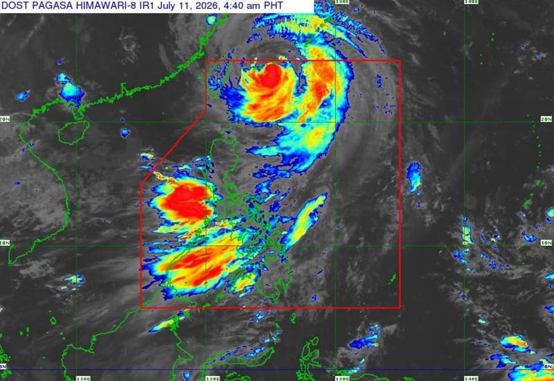
Typhoon Inday is now approaching Sakishima islands in Southern Japan as Signal No. 2 remains over Batanes, according to the Tropical Cyclone Bulletin posted by PAGASA early Saturday morning.
As of 4 a.m., the center of Typhoon Inday was estimated at 500 kilometers northeast of Itbayat, Batanes packing maximum sustained winds of 140 kilometers per hour near the center, gustiness of up to 170 km/h, and central pressure of 950 hPa.
Inday is moving northwestward at the speed of 20 km/h with strong to typhoon-force winds extend outwards up to 880 km from the center.
Tropical Cyclone Wind Signal (TCWS) No. 2 is hoisted over the northern portion of Batanes (Itbayat).
TCWS No. 1 is raised over the following areas:
- the rest of Batanes
- Babuyan Islands
- the northern portion of mainland Cagayan (Santa Ana, Gonzaga, Santa Teresita, Buguey, Camalaniugan, Aparri, Ballesteros, Abulug, Pamplona, Sanchez-Mira, Claveria, Santa Praxedes)
Heavy Rainfall Outlook
Heavy rainfall due to Southwest Monsoon is at 100-200 mm in Zambales, Bataan, Occidental Mindoro, and Antique.
Meanwhile, 50-100 mm of rainfall is forecasted over La Union, Pangasinan, Benguet, Tarlac, Pampanga, Bulacan, Metro Manila, Rizal, Cavite, Laguna, Batangas, Oriental Mindoro, Romblon, Palawan, Aklan, Capiz, Iloilo, Guimaras, Negros Occidental, and Negros Oriental.
Severe Winds
"The enhanced Southwest Monsoon and the periphery of Typhoon Inday will bring strong to gale-force gusts over the following areas (especially in coastal and upland areas exposed to winds) over most of the country," said PAGASA.
Hazards affecting coastal waters
A Gale Warning is in effect over the northern and eastern seaboards of Northern Luzon.
Sea travel is risky for some types or tonnage of vessels. All mariners must remain in port or, if underway, seek shelter or safe harbor as soon as possible until winds and waves subside.
Track and Intensity Outlook
Typhoon Inday is forecast to move northwestward and make landfall or pass close to Sakishima Islands in southern Japan before exiting the Philippine Area of Responsibility (PAR) Saturday morning then will traverse the East China Sea and make landfall over the eastern coast of mainland China.
"Inday is forecast to remain as a typhoon within the next 12 hours before weakening into a severe tropical storm after moving further inland over mainland China," the weather bureau reported. — BAP, GMA News

