

 GMA Brandtalk
 Tracking
 Archives

Josie weakens into LPA - PAGASA
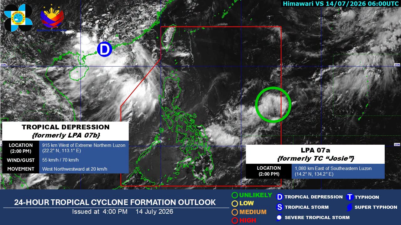
Tropical Depression Josie has further weakened into a low pressure area (LPA) on Tuesday afternoon, the state weather bureau PAGASA said.
"Due to unfavorable environmental conditions, Josie weakened into a low pressure area at 2 p.m. today. The remnant low will move generally north northeastward over the Philippine Sea. However, as the remnant low moves over increasingly less favorable conditions, there is a likelihood that it may dissipate over the Philippine Sea," PAGASA said in its final bulletin on Josie.
As of 4 p.m., the LPA was monitored 1,125 kilometers east of southeastern Luzon.
Meanwhile, another LPA being monitored outside the Philippine Area of Responsibility (PAR), west of the country, has developed into a tropical depression.
As of 3 p.m., the tropical depression was located 940 km west northwest of Extreme Northern Luzon, or in the vicinity of Guangdong, China. It had maximum sustained winds of 55 km/h and gusts of up to 70 km/h and was moving west northwestward at 20 km/h.
Tropical Storm Haishen, locally named Josie, entered PAR early Tuesday. However, it weakened into a tropical depression before further weakening into an LPA.
No wind signals were raised.
In the next 24 hours, the Southwest Monsoon or Habagat is expected to bring rains over the western section of Northern Luzon.
The Habagat may bring partly cloudy to cloudy skies with isolated rain showers or thunderstorms over Ilocos Norte, Ilocos Sur, and Abra.
Metro Manila and the rest of the country are expected to experience partly cloudy to cloudy skies with isolated rain showers or thunderstorms due to localized thunderstorms.
PAGASA warned of possible flash floods or landslides during severe thunderstorms. —Vince Angelo Ferreras/RF/VBL, GMA News

