

 GMA Brandtalk
 Tracking
 Archives

Haishen intensifies into tropical storm, remains outside PAR — PAGASA
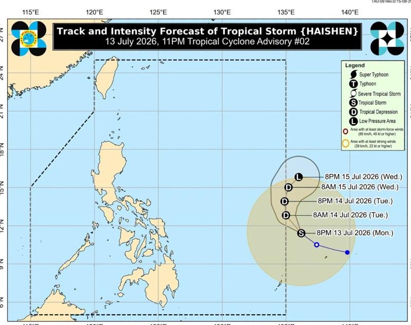
Haishen has intensified into a tropical storm but remains outside the Philippine Area of Responsibility (PAR), according to the Tropical Cyclone Bulletin posted by PAGASA late Monday evening.
The center of Tropical Storm Haishen was estimated at 1,090 kilometers east of Eastern Visayas outside the PAR with maximum sustained winds of 65 kilometers per hour near the center, gustiness of up to 80 km/h, and central pressure of 1002 hPa.
Haishen is moving northwestward at the speed of 20 km/h with strong winds extend outwards up to 480 km from the center.
General Outlook
PAGASA also reported that Haishen will continue moving west northwestward in the next 12 hours and may enter the PAR by midnight or Tuesday morning and will be given the local name Josie.
While inside PAR, Haishen will move generally northward then turn north northeastward until it exits PAR by Wednesday July 15, 2026.
"This tropical cyclone is forecast to steadily weaken due to unfavorable environmental conditions. It is less likely to directly affect the weather and sea conditions in the next days," the weather bureau also said. — BAP, GMA News

