

 GMA Brandtalk
 Tracking
 Archives

LPA outside PAR has high chance of developing into tropical depression - PAGASA
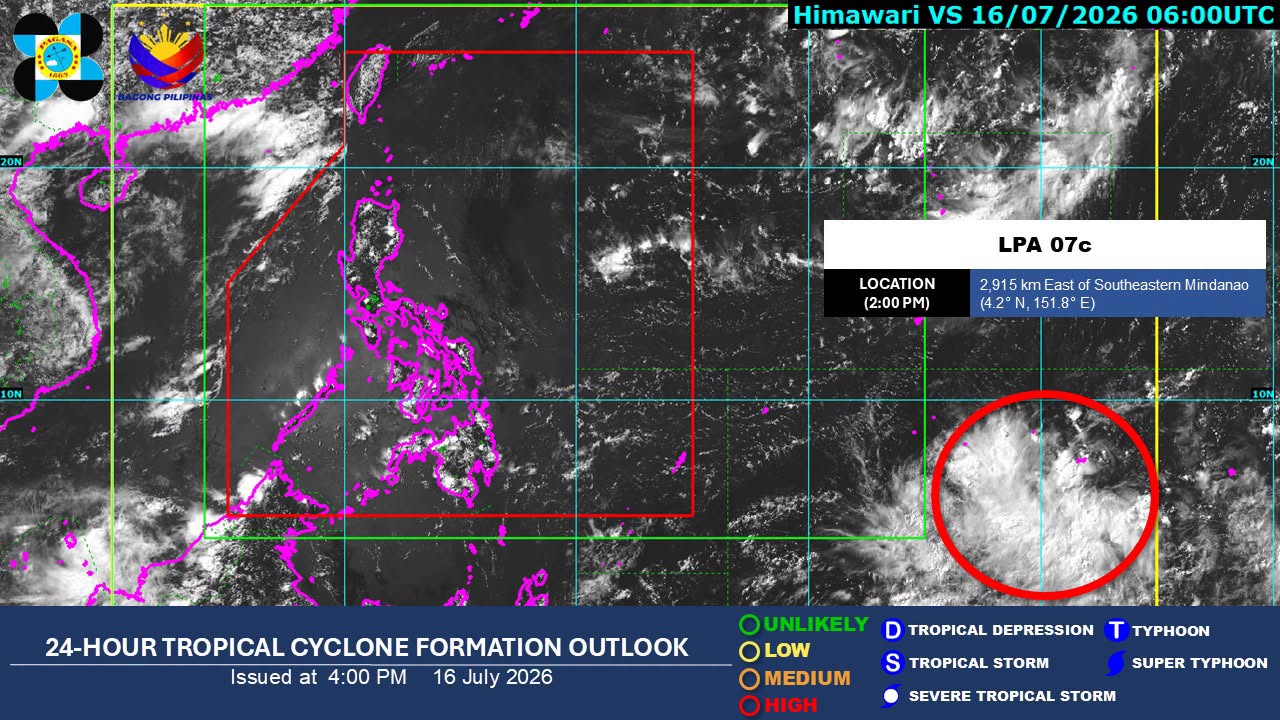
A low pressure area (LPA) being monitored outside of the Philippine Area of Responsibility (PAR) has a high chance of developing into a tropical depression within the next 24 hours, the state weather bureau PAGASA said on Thursday.
As of 3 p.m., the LPA was monitored 2,905 kilometers east of southeastern Mindanao.
PAGASA weather specialist Loriedin De la Cruz-Galicia said the LPA is not expected to affect any part of the country’s landmass in the next two to three days.
She added that the public should continue monitoring PAGASA’s updates due to the weather system’s high level of uncertainty.
Meanwhile, the Southwest Monsoon or Habagat is forecast to affect Extreme Northern Luzon on Friday.
The Habagat is expected to bring partly cloudy to cloudy skies with isolated rain showers or thunderstorms over Ilocos Norte, Ilocos Sur, Abra, Batanes, and Babuyan Islands.
Metro Manila and the rest of the country will experience partly cloudy to cloudy skies with isolated rain showers and thunderstorms because of localized thunderstorms.
PAGASA warned of possible flash floods or landslides during severe thunderstorms. —Vince Angelo Ferreras/VBL, GMA News

