

 GMA Brandtalk
 Tracking
 Archives

PAGASA sees high chance of LPA outside PAR developing into tropical cyclone
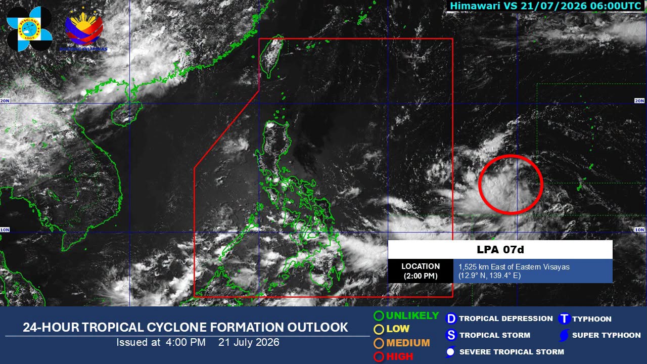
A low pressure area (LPA) outside the Philippine Area of Responsibility (PAR) has a high chance of developing into a tropical depression within the next 24 hours, the state weather bureau PAGASA said on Tuesday.
As of 2 p.m., the LPA was located 1,525 kilometers east of Eastern Visayas.
The trough of the LPA is expected to bring cloudy skies with scattered rains and thunderstorms over Eastern Visayas on Wednesday.
Meanwhile, the Southwest Monsoon, locally known as Habagat, is forecast to bring cloudy skies with scattered rains and thunderstorms over Mindanao, Western Visayas, the Negros Island Region, Central Visayas, and Palawan, according to PAGASA's 4 p.m. weather bulletin.
Metro Manila and the rest of Luzon may experience partly cloudy to cloudy skies with isolated rain showers or thunderstorms due to localized thunderstorms.
PAGASA advised residents in areas affected by the Habagat, localized thunderstorms, and the LPA's trough to remain alert for possible flash floods or landslides during moderate to heavy rains and severe thunderstorms.
Light to moderate winds and slight to moderate coastal waters are expected over Mindanao, Palawan, the Visayas, Central Luzon, and the rest of Southern Luzon, with wave heights ranging from 0.6 to 1.5 meters.
In the rest of Luzon, light to moderate winds and slight to moderate coastal waters are also expected, with waves reaching 0.6 to 1.2 meters.
Sunrise in Metro Manila on Wednesday will be at 5:37 a.m. —Lyjah Tiffany Bonzo/VBL, GMA News

