

 GMA Brandtalk
 Tracking
 Archives

Habagat to bring rains over Luzon, parts of Visayas; Kiyapo now outside PAR
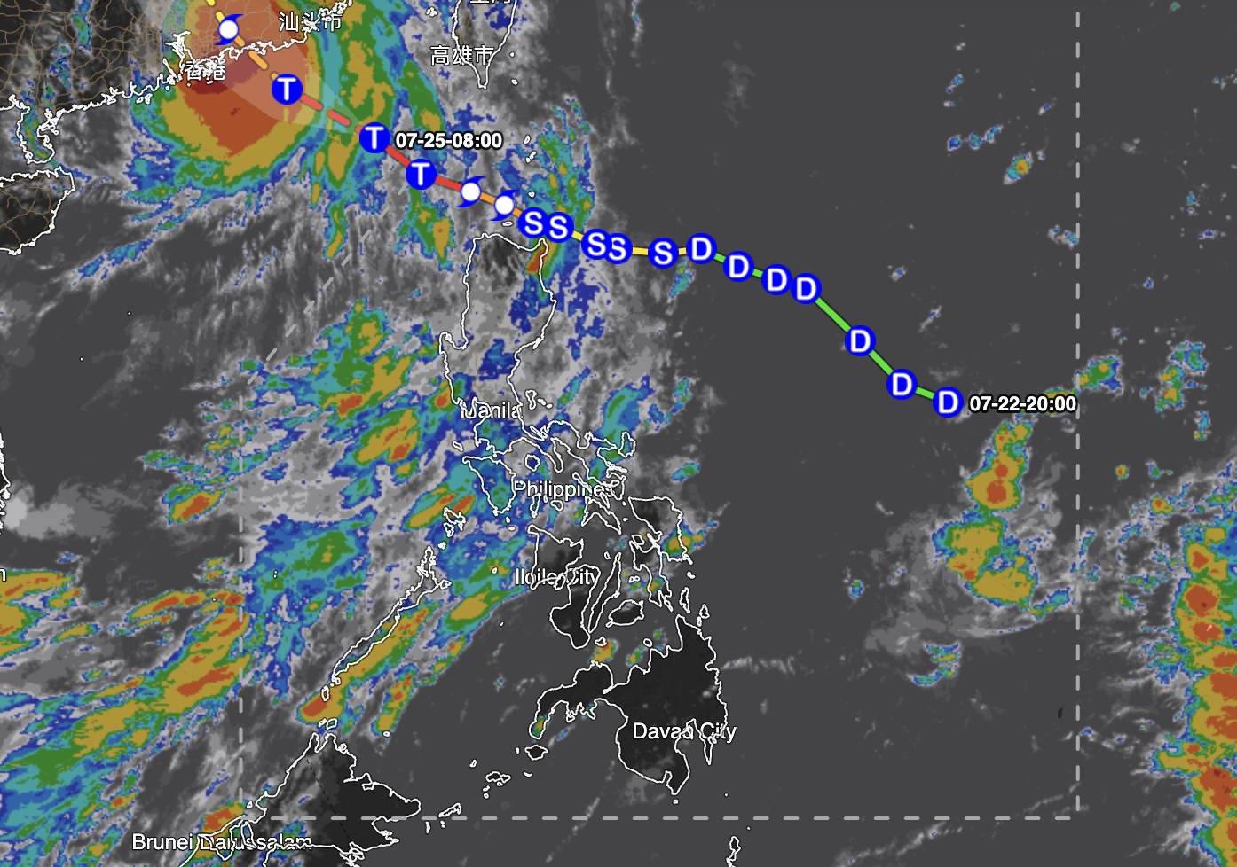
The southwest monsoon or habagat will continue to bring rains over Luzon and parts of the Visayas on Sunday as Typhoon Kiyapo remains outside the Philippine Area of Responsibility (PAR), the Philippine Atmospheric, Geophysical and Astronomical Services Administration (PAGASA) said.
In its 4 a.m. weather forecast, PAGASA said Pangasinan and Zambales will experience occasional rains due to the southwest monsoon, with moderate to heavy rains possibly triggering flash floods or landslides.
Metro Manila, the rest of Luzon, Aklan, and Antique will have cloudy skies with scattered rains and thunderstorms, also due to the southwest monsoon.
PAGASA warned of possible flash floods or landslides in these areas due to moderate to at times heavy rains.
Moderate winds from the south to southeast will prevail over extreme Northern Luzon, with moderate coastal waters and waves ranging from 1.5 to 2.1 meters.
The rest of Luzon will experience light to moderate winds from the southwest to south, with slight to moderate coastal waters and wave heights ranging from 0.6 to 2.1 meters.
Visayas and Mindanao will have light to moderate winds from the southeast to southwest, with slight to moderate coastal waters and waves ranging from 0.6 to 1.8 meters.
The rest of the country will experience partly cloudy to cloudy skies with isolated rain showers or thunderstorms due to localized thunderstorms.
Meanwhile, PAGASA is monitoring Typhoon Kiyapo outside PAR.
As of 3 a.m., Kiyapo was located 745 kilometers west-northwest of Itbayat, Batanes, packing maximum sustained winds of 140 km/h near its center and gusts of up to 195 km/h.
The typhoon was moving northwestward at 20 km/h.
Temperatures at PAGASA's Science Garden station in Quezon City on Saturday ranged from a low of 26°C at 5 a.m. to a high of 31.2°C at 11 a.m.
Sunrise is at 5:38 a.m. on Sunday, while sunset will be at 6:27 p.m. — MCG, GMA News

