ADVERTISEMENT
LIVE
Filtered By: Topstories
News

LIVE UPDATES: Magnitude 7.8 Mindanao earthquake effects (June 10, 2026)


+
Add GMA on Google
Make this your preferred source to get more updates from this publisher on Google.
Search and rescue operations in Calumpang, General Santos City
Auto-refresh

Mindanao earthquake reported death toll now 45 —NDRRMC

The reported fatalities in the magnitude 7.8 earthquake in Mindanao have increased to 45, the National Disaster Risk Reduction and Management Council (NDRRMC) said.

In its report as of 6 p.m. Tuesday, the NDRRMC said 33 of the reported deaths were from Soccsksargen, while 12 were from Davao Region.

A total of 17 people were reported missing and 487 people were reported injured following the earthquake last Monday.

The NDRRMC noted that these figures are still up for validation.

Aftershocks from magnitude 7.8 earthquake in Mindanao reached over 2,000

The Philippine Institute of Volcanology and Seismology (PHIVOLCS) said it has recorded 2,023 aftershocks as of 7 a.m. Wednesday following the magnitude 7.8 earthquake in Mindanao.

According to PHIVOLCS, 528 of the aftershocks have been located, while 47 were felt by residents in affected areas.

Isolated areas after Mindanao earthquake now reached —OCD

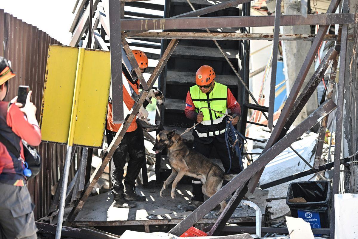
Areas that were initially isolated following the magnitude 7.8 earthquake that struck Mindanao on June 8 have already been reached by government responders, the Office of Civil Defense (OCD) said Wednesday.

In an interview on Super Radyo dzBB, OCD spokesperson Junie Castillo said response teams have managed to access communities that were cut off after roads and bridges sustained damage.

"'Yung isolated areas, as of kahapon, nabanggit naman nila na napuntahan na," Castillo said.

(As of yesterday, they mentioned that they already reached the isolated areas.)

However, Castillo said that access remains a challenge in some areas due to damaged infrastructure, particularly in parts of Soccsksargen.

According to Castillo, some roads and bridges remain impassable, prompting authorities to use alternative routes and sea transport to deliver relief supplies and reach affected communities.

"Kahapon kasi may mga areas na hindi maabot dahil nga sira ‘yung mga kalsada, tulay,” he said.

(Yesterday there were areas that were inaccessible because the roads and bridges were damaged.)

“Ang ginagawa kasi doon ay through the sea vessels. Umiikot 'yung mga response teams natin at 'yung iba naman ay nanggagaling sa kabila," he added.

(What is being done there is through sea vessels. Our response teams are moving around and others are coming from the other side.)

The government has been delivering food, non-food items, tents, fuel, and other essential supplies to residents displaced by the earthquake.

Castillo said the Department of Social Welfare and Development (DSWD) has enough food stocks for affected residents.

Thousands of residents remain in evacuation centers and temporary tent shelters as aftershocks continue to be felt across parts of Mindanao.

Castillo said assessments of infrastructure damage are ongoing.

The death toll from the magnitude 7.8 earthquake that struck parts of Mindanao has risen to 38, according to Castillo.

Agence France-Presse however reported the death toll to have reached 41 as of Tuesday night.

The number of reported missing persons in Soccsksargen increased to eight.

Initial reports from the Department of Public Works and Highways (DPWH) showed there were 18 damaged bridges in Soccsksargen, six of which were nearly impassable. At least 41 roads were also affected, with around 20 rendered impassable.

The earthquake also caused six reported landslides.

Based on reports from the Department of Energy, around 130,000 consumers remained without electricity as of Monday, while 47 gasoline stations were still non-operational.

While some patients have been brought back inside medical facilities, others remain in tents outside hospitals because of continuing aftershocks and concerns over the structural safety of buildings.

Castillo said government workers and residents are also staying outside some government buildings pending structural integrity assessments. —Joviland Rita/KG, GMA News

Massive Mindanao earthquake leaves trail of destruction in Davao Occidental town

The powerful magnitude 7.8 earthquake that struck parts of Mindanao has left severe damage to homes, properties, government buildings, and other infrastructures in Jose Abad Santos, Davao Occidental.

In Barangay Butulan, two individuals were injured after they were hit when their house collapsed following the tremor.

Because the road was rendered impassable, they were transported by motorized banca and brought by sea to the district hospital for treatment. The two were discharged later.

In the town proper, the municipal hall was cordoned off after the earthquake. Local government agencies temporarily set up offices in tents.

In Barangay Magulibas, the barangay hall sustained damage. Even the steel framework of the covered court that has just been repaired could not withstand the strong tremor, causing its roof to collapse.

“Kanang gym namo naghinay-hinay na siya maoy pagkatumba. Pero niuna gyud ang brgy hall sa taas niya. Pasalamat nalang pud ko sa ginoo nga walay tao,” a resident, Alpha Yacon, said.

Cracks and other structural damage were also observed at the adjacent health center and multipurpose hall.

Portions of the concrete road also buckled and developed fissures due to the earthquake.

“Doon muna kami sa dati naming building sa dati naming barangay hall kung saan kami nagasession. Doon muna kami pansamantala. Ngayon lang dito lang kami nag-meeting kasama ng mga kagawad ko para 'di po namin makita 'yung sitwasyon. Parang maging emosyonal po kami na makita ang aming barangay hall,” Barangay Magulibas Chairman Numeriano Salameda Jr. said.

The house of the Bacolod family has lost its walls and is now precariously hanging on the edge of a ravine.

“Dili na Sir kay delikado naman kaayo ang area diri, mangita nalang mi og area kung asa mi makakita.

Trauma gyud tanan mga anak nako. Mulinog lang og gamay makuratan dayon. Muaksyon dayon og hilak, kulbaan gyud sila,” another resident, Leandro Bacolod, said.

The local government has called on the Department of Public Works and Highways (DPWH) and neighboring local government units to assist in road clearing operations on roads that remain impassable due to landslides.

Affected areas include Barangays Tabayon, Malalan, Tanuman, Nuing, Butulan, Sugal, Patulang, Kitayo, Balangonan, and Cayaponga. —Rgil Relator/GMA Regional TV

After Sarangani quake: NIR keeps close eye on active faults

Following the massive magnitude 7.8 earthquake in Sarangani on June 8, 2026, the Office of Civil Defense in Negros Island Region is keeping a close eye on 10 active fault lines in the region.

These active fault lines are the following:

  •     Southern Negros Fault
  •     Manjuyod-Pamplona Fault (East Negros Fault System)
  •     Bindoy-Guihulngan Fault (East Negros Fault System)
  •     Pinocawan River Fault (East Negros Fault System)
  •     San Carlos Fault (East Negros Fault System)
  •     Calatrava-Toboso Fault (East Negros Fault System)
  •     Sibulan Fault
  •     Central Negros Fault
  •     Candoni Fault
  •     West Negros Fault

Bryll Larry Sañor, Deputy Chief of the Provincial Disaster Risk Reduction and Management Office Operations Center, said the faults can generate a magnitude of up to 6.9.

“Nandyan sa 6.9 magnitude ang pwedeng (maramdaman). Mayroon rito sa San Carlos City, Toboso, Central Negros Fault, Himaymaylan, Binalbagan, La Carlota, La Castellana (at) mga Central Negros and south naton na LGUs,” he said.

Donato Sermeno III, Regional Director of OCD-NIR said there is also the possibility of movement at the Negros Trench.

“As well as ang Negros Trench na mino-monitor. There is a possibility na gumalaw sya,” Sermeno said.

As part of preparedness efforts, PDRRMO is giving particular attention to simulations at schools and neighborhoods.

When the earthquake in Sarangani struck, thousands of students and teachers were already in school for the opening of classes.

One can say the flag ceremony saved many lives because the students and teachers were in open spaces at exactly the same time the quake hit.

Sarangani quake

In the earthquake in Sarangani, up to Intensity VII was felt by residents in General Santos City where structures were damaged or destroyed.

Based on PHIVOLCS’ intensity scale, Intensity VII is classified as ‘destructive’ with this description:

“Most people are frightened and run outdoors. People find it difficult to stand in upper floors. Heavy objects and furniture overturn or topple. Big church bells may ring. Old or poorly-built structures suffer considerable damage. Some well-built structures are slightly damaged. Some cracks may appear on dikes, fish ponds, road surface, or concrete hollow block walls. Limited liquefaction, lateral spreading and landslides are observed. Trees are shaken strongly. (Liquefaction is a process by which loose saturated sand lose strength during an earthquake and behave like liquid).”

At least 38 people died and at least 478 were injured in the Sarangani quake, as of the latest count of OCD evening on Tuesday, November 9, 2026.

At least 1,000 aftershocks were recorded.

The earthquake damaged roads and bridges in Maasim, Sarangani and left a trail of destruction in Davao Occidental.

Cause

According to PHIVOLCS, the quake in Sarangani was caused by movement along the Cotabato Trench.

It had a depth of 33 kilometers and the epicenter was traced 32 kilometers west of Maasim, Sarangani.

PHIVOLCS said the quake’s location, focal mechanism, and aftershock pattern point to subduction along the Cotabato Trench, which is a major earthquake-generating structure off the coast of Mindanao.

Sarangani faces the Cotabato Trench.

Sarangani and the provinces nearby sit near a seismically active area. — with reports from GMA Regional TV One Western Visayas/GMA Regional TV

Lola and grandson isolated after strong earthquake in Mindanao, relatives seek help

A woman and her grandson in Malapatan, Sarangani were separated from relatives following the magnitude 7.8 earthquake that hit the province and nearby areas on Monday morning, according to a report on "State of the Nation."

The video footage showed a woman quickly entering the house and grabbed a boy sitting on a sofa just as the strong earthquake hit the area.

The woman lost her balance, slipped and fell to the ground as she gripped the curtain hanging by the doorway.

She can be seen sitting on the floor as the ground shook, displacing furniture and items fell to the floor.

The boy's father, who was in Polomolok, South Cotabato, as a barangay rescuer said the woman and her grandson were the only ones left at the house.

They remained isolated because there is no power supply and no phone service. Their supply of drinking water is about to run out.

He also said that the woman was shouting because their 104-year-old grandmother is alone in the other house.

They are calling for help for the woman and her grandson. — BAP, GMA News

Alabel, Glan towns in Sarangani under state of calamity after Mindanao earthquake

Alabel, Sarangani’s capital town, has been placed under a state of calamity in the wake of the destructive magnitude 7.8 earthquake that hit off the coast of Sarangani on Monday morning.

The Sangguniang Bayan approved the resolution declaring the state of calamity in a special session, according to the Alabel Information Office’s Facebook page.

“Based on the post-disaster assessment and communication from the Office of the Municipal Mayor, the council reported significant damage in Barangays Pag-asa, New Canaan, Bagacay, and Paraiso,” the Alabel Information Office said.

The town council also expressed its sympathy to the affected residents and assured continued support for relief and recovery efforts.

It also urged the public to be vigilant and prioritize safety as assessment and response operations continue.

Earlier in the day, the town of Glan, Sarangani – which was almost isolated as a result of the powerful earthquake – was also placed under a state of calamity.

Glan Vice Mayor James Yap Jr. shared photos of the Sangguniang Bayan’s resolution declaring the state of calamity in the town.

On Monday, General Santos City was also placed under a state of calamity in the wake of the massive earthquake that has left 41 dead as of Tuesday, June 9, 2026.

The declaration of a state of calamity allows a local government unit (LGU) to access and release disaster response funds and tap emergency powers in response to a calamity. — JMA, GMA News

Three strong aftershocks hit Sarangani — PHIVOLCS

Three strong aftershocks were reported to have occurred in Sarangani, Davao Occidental early Wednesday morning, the Philippine Institute of Volcanology and Seismology (PHIVOLCS) reported.

The first earthquake occurred at 12:49 a.m. off the coast of Balut Island in the municipality of Sarangani, Davao Occidental.

It was initially reported by PHIVOLCS as having magnitude 5.9. However, the agency later downgraded it to magnitude 5.0.

The earthquake was tectonic in origin and had a depth of 19 km.

The earthquake was felt in the following areas as follows:

  •     Intensity IV - General Santos City
  •     Intensity I - Davao City

At 1:40 a.m., a magnitude 5.0 aftershock occurred offshore Balut Island, Sarangani, Davao Occidental, PHIVOLCS said. 

It had a depth of 15 km and was tectonic in origin. 

Another aftershock had a magnitude 5.1 and was recorded to have occurred at 2:09 a.m. on Sarangani Island, Sarangani, Davao Occidental.

Its depth was 10 kilometers. The earthquake was tectonic in origin

The three earthquakes were aftershocks of the magnitude 7.8 earthquake that hit Maasim, Sarangani on Monday.

PHIVOLCS said aftershocks may still occur. — BAP/KG, GMA News