

 GMA Brandtalk
 Tracking
 Archives

ITCZ to bring rains, thunderstorms over parts of PH
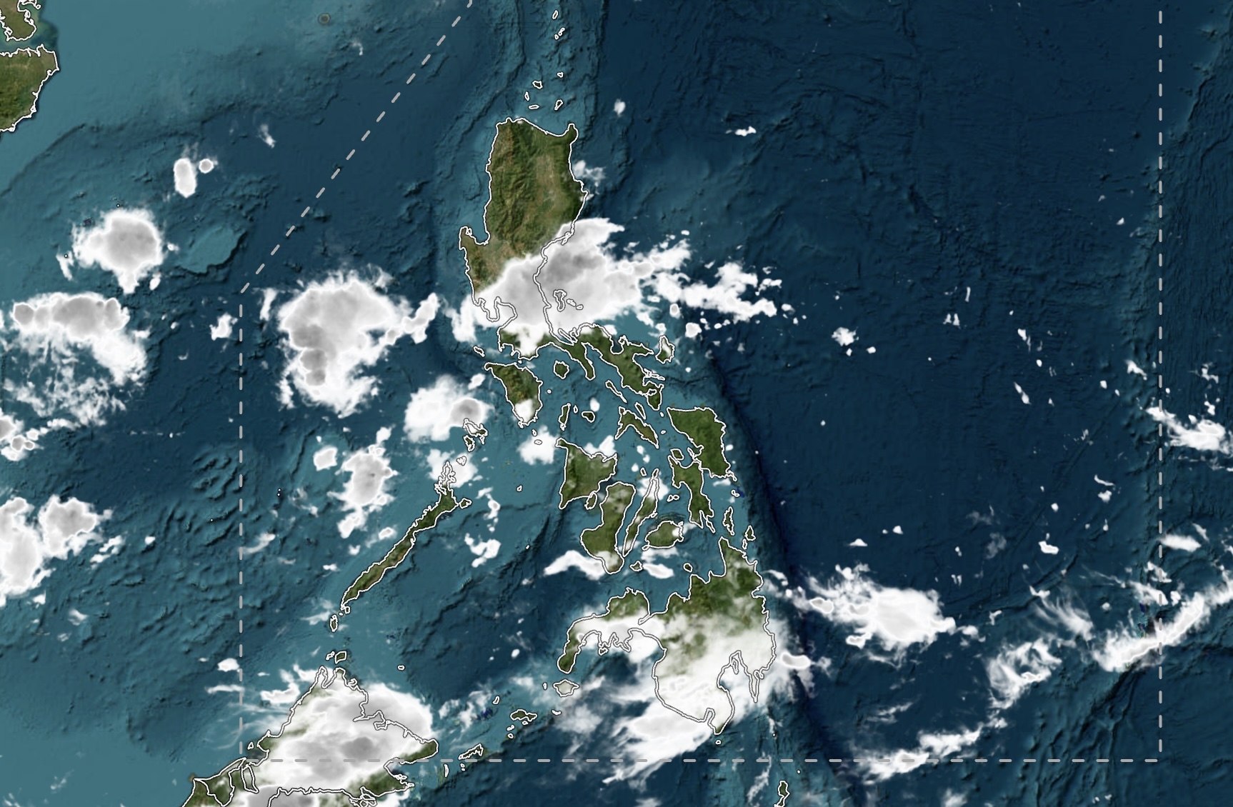
The intertropical convergence zone (ITCZ) will bring cloudy skies with scattered rains and thunderstorms over parts of the Philippines on Sunday, October 11, with the state weather bureau PAGASA warning of possible flash floods and landslides.
In its 4 a.m. weather forecast, PAGASA said the ITCZ would affect Southern Luzon, the Visayas and Mindanao, while easterlies would affect the eastern sections of Northern and Central Luzon.
Mindanao, the Bicol Region, MIMAROPA, Western Visayas and the Negros Island Region will experience cloudy skies with scattered rains and thunderstorms due to the ITCZ.
Metro Manila, CALABARZON, the rest of Cagayan Valley, Aurora, Nueva Ecija and Bulacan will also have cloudy skies with scattered rains and thunderstorms due to the easterlies.
PAGASA warned that moderate to at times heavy rains could trigger flash floods or landslides in these areas.
Batanes will have cloudy skies with rains due to the northeasterly windflow, with similar risks of flash floods and landslides.
The rest of the Visayas and Luzon will experience partly cloudy to cloudy skies with isolated rain showers or thunderstorms. Severe thunderstorms could trigger flash floods or landslides in these areas.
PAGASA said moderate to strong winds from the northeast to east would prevail over Northern Luzon and the eastern section of Central Luzon, where coastal waters could be moderate to rough, with waves reaching 1.5 to 2.8 meters.
The rest of Luzon will have light to moderate winds from the east to northeast, with slight to moderate coastal waters and wave heights of 0.6 to 2.1 meters.
Light to moderate winds will prevail over the Visayas, coming from the southeast to northeast, and over Mindanao, coming from the southwest to southeast. Coastal waters in both regions will be slight to moderate, with waves reaching 0.6 to 1.8 meters.
As of 3 a.m. Sunday, Typhoon Koguma was located 2,795 kilometers east-northeast of extreme Northern Luzon, outside the Philippine Area of Responsibility (PAR).
Koguma had maximum sustained winds of 175 kilometers per hour near its center, with gusts of up to 215 kph. It was moving northwestward at 20 kph.
A tropical depression was also being monitored 2,940 kilometers east of Southern Luzon, outside PAR. It had maximum sustained winds of 45 kph and gusts of up to 55 kph, and was moving east-northeastward at 20 kph.
At the PAGASA weather station in Science Garden, Diliman, Quezon City, the maximum temperature recorded on Saturday was 31.0 degrees Celsius at 2 p.m., while the minimum was 25.2 degrees Celsius at 6 a.m.
The sun will rise over Metro Manila at 5:47 a.m. and set at 5:39 p.m. on Sunday.— MCG, GMA NewsFollow GMA News Online on Facebook for real-time news and developments in the Philippines and around the world.

