

 GMA Brandtalk
 Tracking
 Archives


EXPLAINER: Why do storms still occur during El Niño?
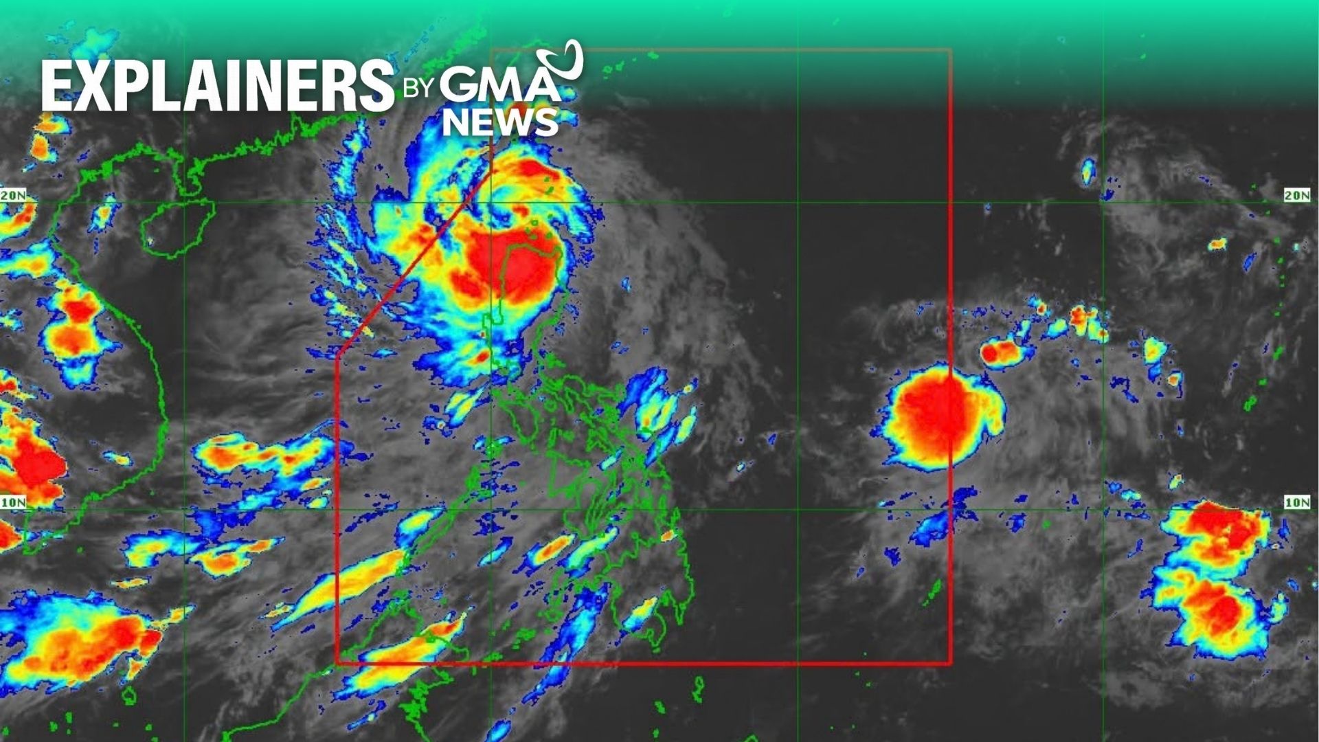
Several areas in northern Luzon were placed under Tropical Cyclone Wind Signal No. 1 on Tuesday after Super Typhoon Champi entered the Philippine Area of Responsibility (PAR) and was given the local name Rosal.
State weather bureau PAGASA said Central Luzon and Metro Manila may experience rains in the coming days, as the storm nears the country's landmass.
While El Niño is generally associated with reduced rainfall, PAGASA said warmer ocean temperatures could still provide favorable conditions for tropical cyclone development, including typhoons and super typhoons.
PAGASA said the average temperature across the Philippines is expected to rise by 1 to 2 degrees Celsius during the El Niño phenomenon.
In a Tuesday press briefing, PAGASA Climate Monitoring and Prediction Section Chief Ana Liza Solis said historical records show that more tropical cyclones reach typhoon or super typhoon strength during El Niño, regardless of whether the phenomenon is classified as weak, moderate, strong, or very strong.
"Usually, mas marami pa yung land falling and crossing na bagyo of typhoon and super typhoon category kapag may El Niño during the months of October," Solis said.
(Usually, more typhoons and super typhoons make landfall or cross the country during El Niño, particularly in October.)
"It so happens na very unusual itong track ng bagyo dahil at this time of the year, supposedly land falling and crossing ng bagyo pero ngayon nakikita may recurving ng bagyo," she added.
(It so happens that the storm’s track is very unusual because, at this time of the year, tropical cyclones are typically expected to make landfall and cross the country. However, the current forecast shows the storm recurving instead.)
Solis explained that one characteristic of tropical cyclones during El Niño is that their tracks may change.
According to PAGASA’s tropical cyclone bulletin, Rosal is expected to move west-northwestward until Wednesday, October 21, before turning generally northwestward until Friday morning, October 23.
By Friday, Rosal is forecast to turn north-northwestward to northward before exiting the Philippine Area of Responsibility (PAR) that evening or early Saturday morning, October 24, PAGASA said.
PAGASA Deputy Administrator for Research and Development Marcelino Villafuerte earlier said the Philippines is already experiencing a strong El Niño, which is expected to intensify further before the end of the year.
Solis said PAGASA would release regular heat index forecasts in the coming days to inform the public about the expected temperatures across the country.
Several government agencies have also launched initiatives, plans, and technology that they plan to use to mitigate the effects of the extreme heat and dry conditions.
Meanwhile, the public has been advised to store water and conserve supplies amid the risk of water shortages as drought conditions worsen. —VAL/VBL, GMA News

