

Caloy maintains strength, weakening to begin Sunday
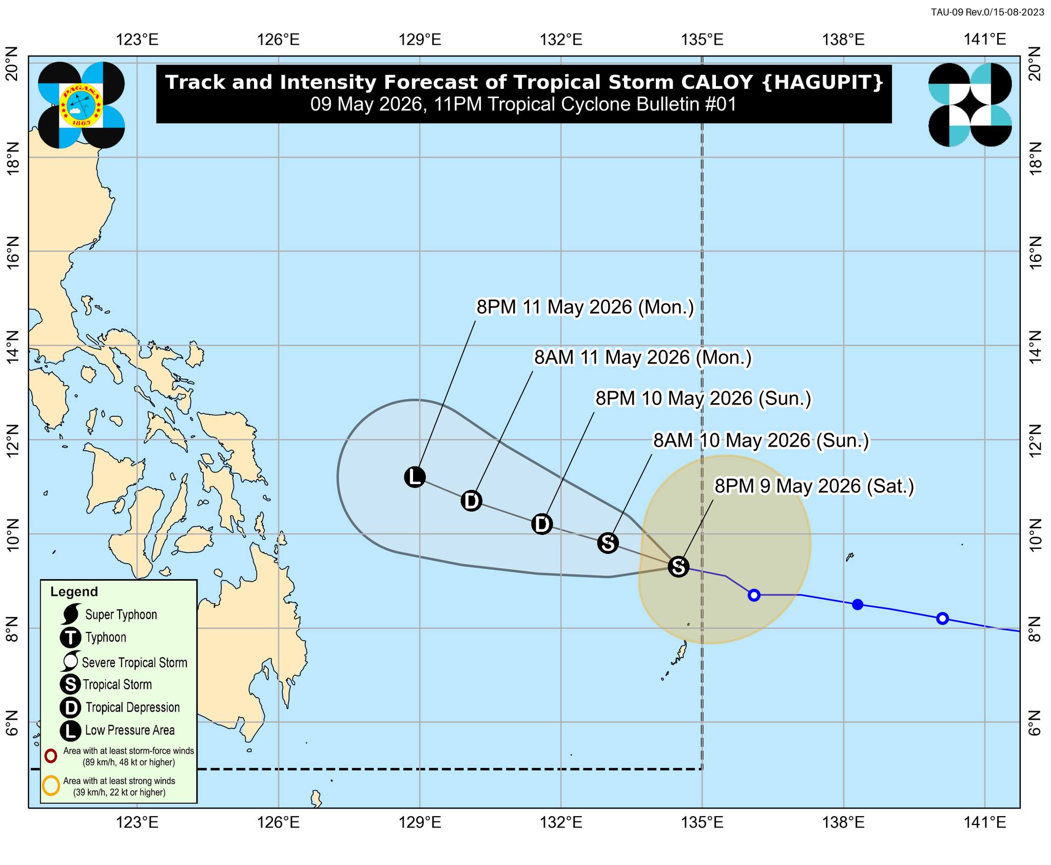
Tropical Storm Caloy has maintained its strength while traversing the Philippine Sea, but starting on Sunday, it will gradually weaken, PAGASA said late Saturday night.
Far from the Philippine landmass, Caloy was spotted 870 km east of Northeastern Mindanao, carrying maximum sustained winds of 65 km/h near the center and gustiness of up to 80 km/h.
It is expected to move west northwestward at 20 km/h.
"In the next 12 hours, Caloy may maintain its strength. A weakening trend will likely begin tomorrow (May 10) evening. It is forecast to weaken into a tropical depression by tomorrow evening and further weaken into a remnant low on Monday (May 11)," PAGASA said.
The weather in the country won't be directly affected by Caloy, it said. — VBL, GMA News
