

PAGASA tracks 2 LPAs, both unlikely to develop into tropical depression
The Philippine Atmospheric, Geophysical and Astronomical Services Administration (PAGASA) is currently monitoring two Low Pressure Areas (LPAs) and both are unlikely to develop into a tropical depression within the next 24 hours.
Localized thunderstorms will bring cloudy partly cloudy to cloudy skies with isolated rain showers and thunderstorms to parts of the country. Flash floods or landslides may occur, the weather bureau said, during severe thunderstorms.
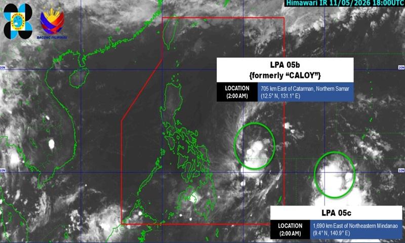
At 3 a.m., the LPA (formerly "Caloy") was estimated at 690 kilometers east of Catarman, Northern Samar and within the Philippine Area of Responsibility (PAR) is unlikely to develop into a tropical depression within the next 24 hours.
Meanwhile, another Low Pressure Area (LPA 05c) is being monitored outside the PAR and is also unlikely to develop into a tropical depression within the next 24 hours.
Forecast Wind and Coastal Water Conditions
The eastern section of Southern Luzon, Visayas, and the northeastern section of Mindanao will experience light to moderate wind speed moving in the northeast to northwest direction while coastal waters will be slight to moderate.
The wind speed forecast for the rest of Luzon is light to moderate moving in the southeast to northeast direciton with slight to moderate coastal waters.
The rest of Mindanao will experience light to moderate wind speed with variable movement and slight to moderate coastal waters.
Sunrise will be at 5:29 a.m., sunset at 6:16 p.m. — BAP, GMA News
