

Typhoon Francisco weakens further over PH Sea
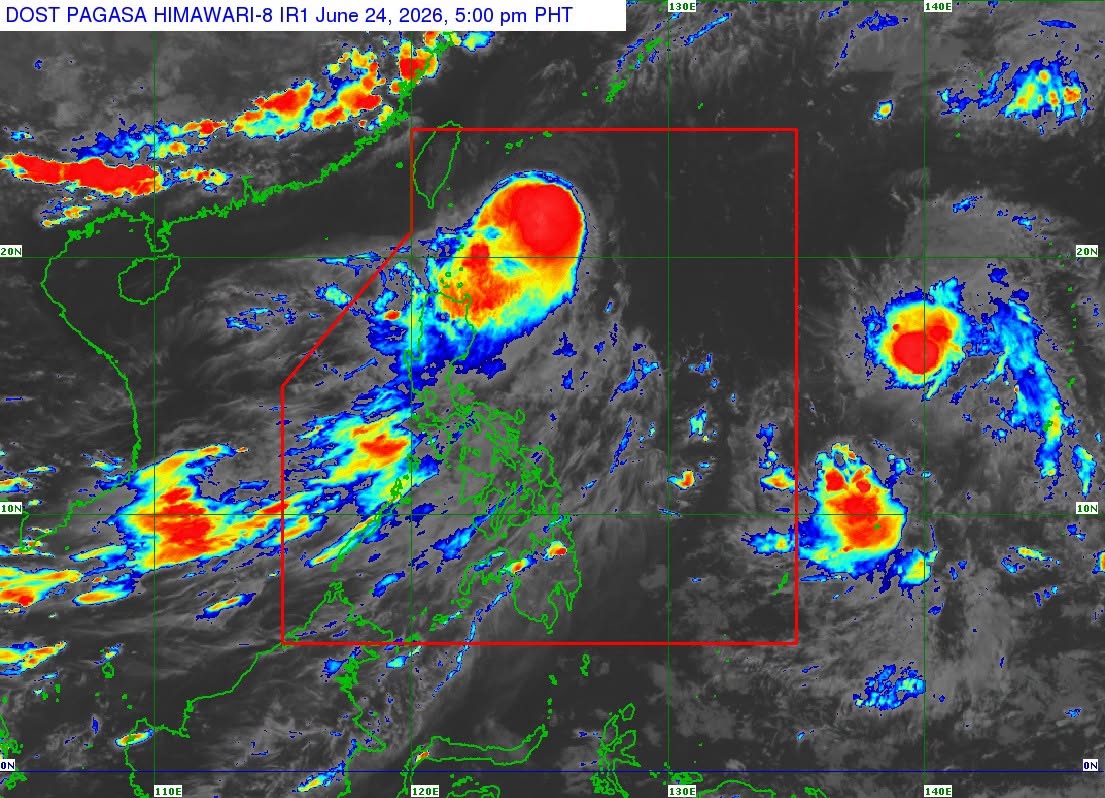
Typhoon Francisco continued to weaken as it moved northward east of Southern Taiwan over the Philippine Sea, the state weather bureau said on Wednesday afternoon.
In its 5 p.m. tropical cyclone bulletin, PAGASA said Signal No. 1 remains hoisted over Batanes and the northeastern portion of Cagayan (Gonzaga, Santa Ana), including Babuyan Islands.
It is packing maximum sustained winds of 130 km/h near the center with gustiness of up to 160 km/h and central pressure of 970 hPa. It is moving northward at 15 km/h.
As of 4 p.m. of June 24, the center of the typhoon was estimated based on all available data at 320 km east northeast of Itbayat, Batanes (22.1°N, 124.6°E).
PAGASA said Typhoon Francisco will continue moving northward within the next 12 hours before turning north northeastward towards the Ryukyu Islands and sea south of mainland Japan.
It is forecast to gradually weaken throughout the forecast period, although it will likely remain a typhoon while inside the PAR.
It will exit the Philippine Area of Responsibility (PAR) by afternoon or evening Thursday, June 25.
The Southwest Monsoon or Habagat and the periphery will bring strong to gale-force gusts over the following areas:
Wednesday, June 24
- Most of Luzon
- Visayas
- Misamis Occidental
- Lanao del Norte
- Camiguin
- Dinagat Islands
- Davao Occidental, and
- Davao Oriental.
Thursday, June 25
- Most of Luzon
- Panay Island
- Negros Occidental, and
- Northern Samar.
The state weather bureau warned of rough seas of the following coastal waters:
- Up to 4.0 m: The eastern seaboard of Batanes.
- Up to 3.5 m: The remaining seaboard of Batanes; the northern seaboard of Babuyan Islands.
- Up to 3.0 m: The remaining seaboard of Babuyan Islands.
“Mariners of small seacrafts, including all types of motorbancas, are advised not to venture out to sea under these conditions, especially if inexperienced or operating ill-equipped vessels,” PAGASA added. — JMA, GMA News
