

 GMA Brandtalk
 Tracking
 Archives

PAGASA not ruling out possibility of Super Typhoon Dolphin entering PAR
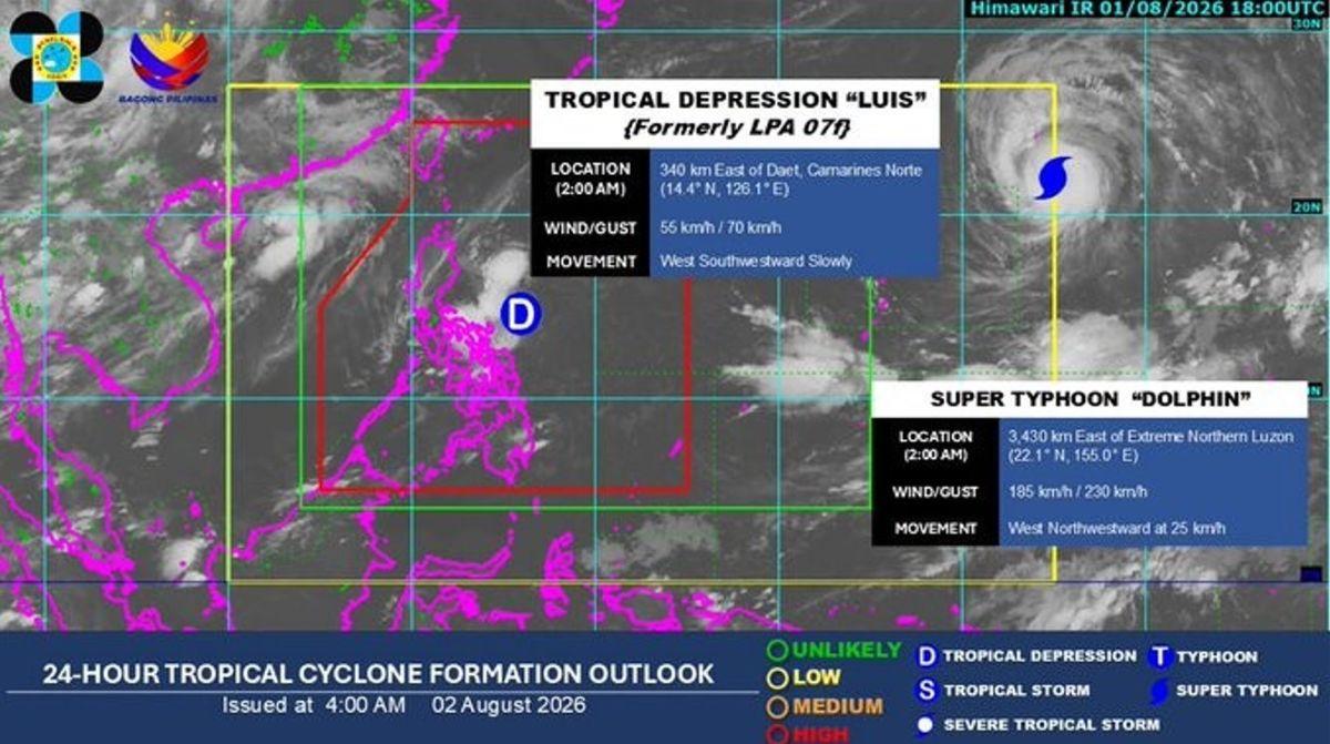
State weather bureau PAGASA said on Sunday that it is not ruling out the possibility that Super Typhoon Dolphin could enter the Philippine Area of Responsibility (PAR) in the coming days.
"Kung papasok kasi ito ng PAR, sa may northeastern boundary lamang po. So in the next few days, possible mga late next week, around mga second half ng next week kung papasok man ito," said PAGASA weather forecaster Veronica Torres, according to a report on Super Radyo dzBB.
(If it enters PAR, it will only be near the northeastern boundary. So in the next few days—possibly late next week, around the second half of next week—if it enters at all.)
Once it enters PAR, it will be given the local name "Maymay."
As of 2 a.m., Dolphin was monitored 3,430 kilometers east of extreme northern Luzon.
It packs a maximum wind of 185 kilometers per hour near the center, and gustiness of up to 230 kilometers per hour.
The super typhoon is also moving west northwestward at 25 kilometers per hour. —Vince Angelo Ferreras/KG, GMA News

