

 GMA Brandtalk
 Tracking
 Archives

Tropical Depression Neneng slightly intensifies; Habagat to prevail over Luzon, 2 other areas
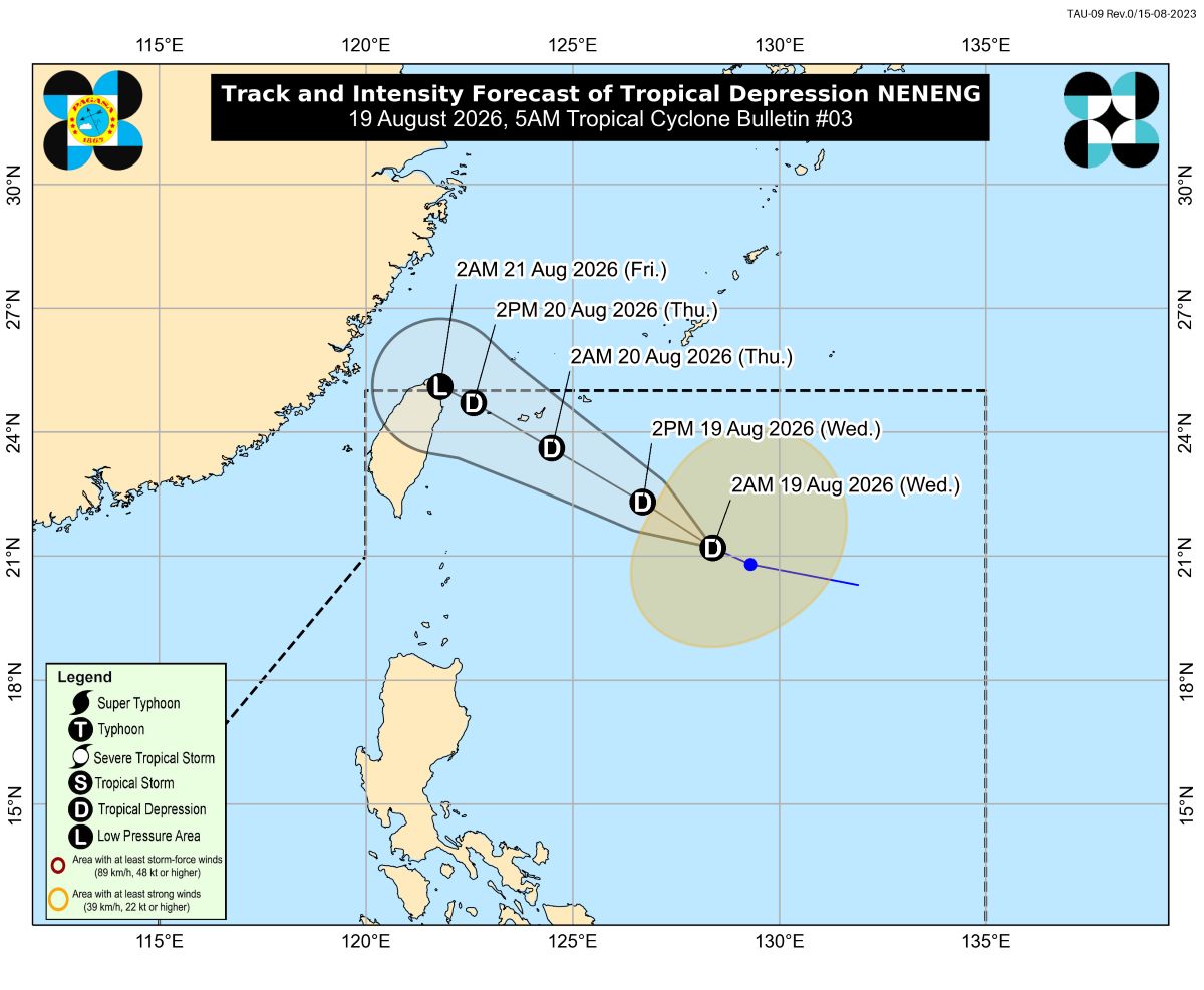
Tropical Depression Neneng slightly intensified as it continued to move over the waters off Batanes, state weather bureau PAGASA said in its 5 a.m. Wednesday bulletin.
As of 4 a.m., Neneng was located 675 kilometers east of Itbayat, Batanes, packing maximum sustained winds of 55 km/h near the center and gustiness of up to 70 km/h.
It was moving northwestward at 15 km/h.
PAGASA said Neneng is expected to make landfall along the eastern coast of Taiwan between Thursday afternoon and Friday morning.
“Neneng will remain a tropical depression in the next 36 hours before weakening into a remnant low over or near Taiwan on Friday morning. However, earlier weakening into a remnant low is not ruled out,” PAGASA said.
PAGASA is also monitoring two tropical cyclones outside the Philippine Area of Responsibility.
Meanwhile, the Southwest Monsoon (Habagat) will prevail over Luzon, Antique, and Aklan, bringing cloudy skies and rains in the next 24 hours.
Zambales, Bataan, and Occidental Mindoro will have 100 to 200 mm of heavy rains on Wednesday, according to PAGASA's heavy rainfall outlook for the Southwest Monsoon.
Metro Manila, La Union, Benguet, Pangasinan, Ilocos Sur, Abra, Tarlac, Pampanga, Bulacan, Nueva Ecija, Cavite, Batangas, Laguna, Rizal, and Oriental Mindoro meanwhile may expect 50 to 100 mm of rains today.
Mindanao and the rest of Visayas on the other hand will experience localized thunderstorms.
Moderate to strong winds and moderate to rough seas are expected over the northern and western sections of Luzon.
Moderate winds and moderate seas are forecast over the eastern section of the Philippines.
The rest of the country will experience light to moderate winds and slight to moderate seas. —VBL/KG, GMA News

