

 GMA Brandtalk
 Tracking
 Archives

Tropical depression outside PAR developed into tropical storm — PAGASA
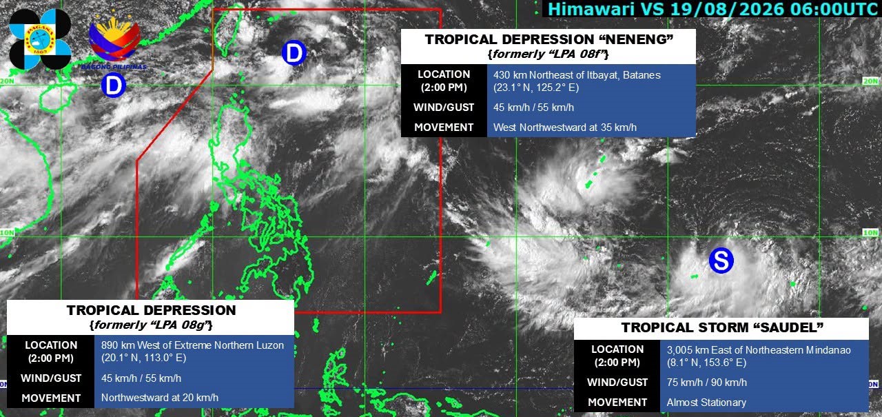
One of two tropical depressions being monitored outside of the Philippine Area of Responsibility (PAR) has developed into a tropical storm, state weather bureau PAGASA said Wednesday afternoon.
As of 2 p.m. Wednesday, Tropical Storm Saudel was monitored 3,005 kms east of northeastern Mindanao. It packed maximum sustained winds of 75 kph, and gusts of up to 90 kph.
PAGASA said the weather disturbance was almost stationary.
On the other hand, the other tropical depression remains outside PAR at 890 kms west of extreme northern Luzon.
Meanwhile, Tropical Depression Neneng was last spotted 430 kms northeast of Itbayat, Batanes.
It packed maximum sustained winds of 45 kph near the center. It also carried gusts of up to 55 kph.
Neneng was moving west northwestward at 35 kph.
According to the 24-hour weather forecast issued at 4 p.m., the southwest monsoon or Habagat will continue to dampen parts of the country on Thursday.
Monsoon rains are expected over Zambales, Bataan, and Occidental Mindoro.
The Habagat is also forecast to bring occasional rains over Metro Manila, Ilocos Sur, La Union, Pangasinan, Abra, Benguet, Tarlac, Pampanga, Bulacan, Nueva Ecija, Laguna, Rizal, Cavite, Batangas, and Oriental Mindoro.
Further, the monsoon is expected to bring cloudy skies with scattered rains and thunderstorms over the rest of Luzon, Antique, and Aklan.
Meanwhile, the localized thunderstorms might bring partly cloudy to cloudy skies with isolated rain showers or thunderstorms over Mindanao and the rest of the Visayas. — VDV, GMA News

