

 GMA Brandtalk
 Tracking
 Archives

Habagat to prevail over most of Luzon; 2 tropical cyclones outside PAR
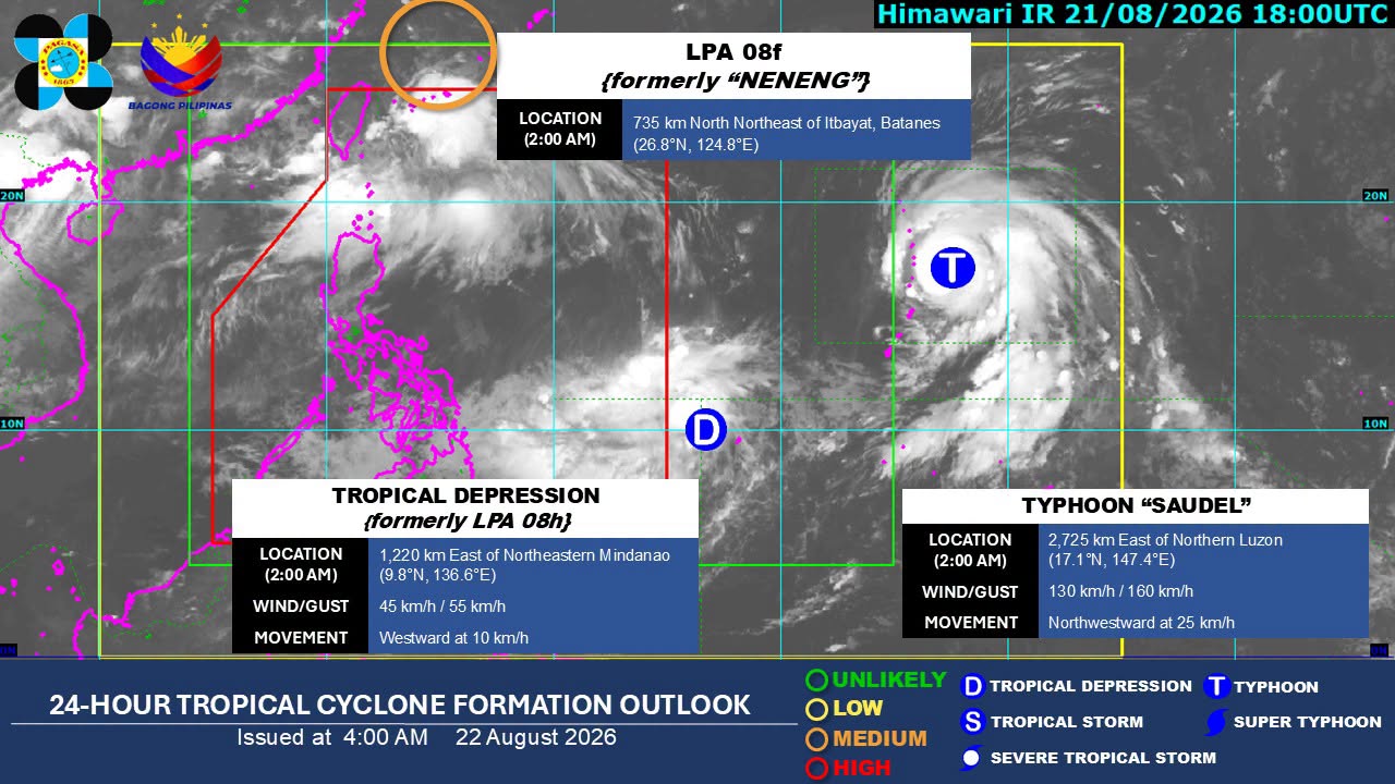
The Southwest Monsoon (Habagat) will affect most of Luzon within the next 24 hours, PAGASA said in its early Saturday morning forecast.
Due to the Habagat, the Ilocos Region, Cordillera Administrative Region, Batanes, Cagayan, Zambales, Bataan, Tarlac, and Pampanga will experience cloudy skies with scattered rains and thunderstorms.
Metro Manila, CALABARZON, the rest of Cagayan Valley, and the rest of Central Luzon will have partly cloudy to cloudy skies with isolated rain showers or thunderstorms.
The rest of the country will see partly cloudy to cloudy skies with isolated rain showers or thunderstorms due to localized thunderstorms.
Tropical cyclones
As of 3 a.m., Typhoon Saudel was located 2,710 kilometers east of Northern Luzon. It was moving northwestward at 25 km/h, packing maximum sustained winds of 130 km/h near the center and gustiness of up to 160 km/h.
Meanwhile, the low pressure area east of northeastern Mindanao had developed into a tropical depression. As of 3 a.m., it was packing maximum sustained winds of 45 km/h near the center and gustiness of up to 55 km/h. It was moving westward at 10 km/h.
Moderate to strong winds and moderate to rough coastal waters are forecast over the northern and western sections of Luzon.
The rest of the country will experience light to moderate winds and slight to moderate seas.
Sunrise in Metro Manila was at 5:43 a.m., while sunset is expected at 6:15 p.m. —VBL, GMA News

