

 GMA Brandtalk
 Tracking
 Archives

Typhoon Saudel maintains strength over PH Sea; to enter PAR on Monday
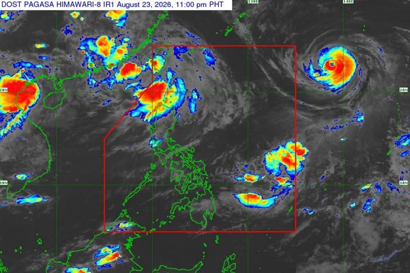
Typhoon Saudel maintains its strength as it moves west northwestward over the Philippine Sea east of extreme Northern Luzon, the state weather bureau PAGASA said Sunday in its 11 p.m. advisory.
As of 10 p.m., Typhoon Saudel was estimated outside the Philippine Area of Responsibility (PAR) at 1,775 km east of Extreme Northern Luzon, with maximum sustained winds of 165 kph and gusts up to 205 kph.
PAGASA said Saudel is expected to enter the northeastern boundary of PAR by morning or afternoon of August 24, when it will be given the local name Obet.
Before entering the PAR on Monday, Typhoon Saudel is forecast to reach Super Typhoon category.
"The tropical cyclone is less likely to directly affect the weather and sea conditions in the country in the next three days," PAGASA noted.
"Based on the forecast track, Saudel will remain over the Philippine Sea and will exit the PAR by Tuesday (25 August)," it added.
Heavy rainfall outlook due to Southwest Monsoon, from 50 mm to 100mm on Sunday evening to Monday evening over Batanes, according to the Weather Advisory posted by PAGASA on 11 p.m.
"Forecast rainfall may be higher in mountainous and elevated areas. Moreover, impacts in some areas may be worsened by significant antecedent rainfall," the agency said. — BAP, GMA News

