
Tisoy maintains strength, brings 'violent' winds and heavy rain to three areas
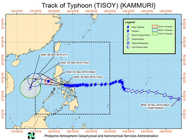
Typhoon Tisoy maintained its strength on Tuesday morning as its "eyewall" brought "violent winds and heavy to intense rainfall" over southern Quezon, Marinduque, and Romblon, PAGASA said in its 8 a.m. update.
It said the eyewall is expected to affect Cavite, Batangas and the northern portion of Mindoro provinces within three hours, and to make landfall or pass close to Marinduque-Simara Island-Banton Island area before noon.
As of 8 a.m., the following areas were under Tropical Cyclone Wind Signal (TCWS) No. 3:
- Camarines Sur,
- Albay,
- Camarines Norte,
- Masbate including Ticao and Burias Islands,
- Romblon,
- southern portion of Quezon (Perez, Alabat, Quezon, Mauban, Sampaloc, Lucban, Tayabas, Pagbilao, Lucena, Sariaya, Candelaria, Dolores, Tiaong, San Antonio, Atimonan, Padre Burgos, Agdangan, Plaridel, Unisan, Pitogo, Gumaca, Lopez, Macalelon, General Luna, Calauag, Catanauan, Guinayangan, Tagkawayan, Buenavista, Mulanay, San Narciso, San Francisco, San Andres),
- Marinduque,
- Oriental Mindoro,
- Occidental Mindoro including Lubang Island,
- Batangas,
- Cavite, and
- Laguna
Meanwhile, under TCWS No. 2 were:
- Catanduanes,
- Sorsogon,
- Metro Manila,
- Bulacan,
- Bataan,
- Tarlac,
- Pampanga,
- Nueva Ecija,
- southern Aurora (Dipaculao, Maria Aurora, Baler, San Luis, Dingalan),
- Rizal,
- rest of Quezon including Polillo Islands,
- Calamian Islands (Coron, Busuanga, Culion, Linapacan),
- Cuyo Islands (Cuyo, Magsaysay, Agutaya),
- Zambales,
- Pangasinan,
- Northern Samar,
- Aklan,
- Capiz,
- Northern Antique (Caluya, Libertad, Pandan, Sebaste, Culasi, Tibiao), and
- Northern Iloilo (Carles, Balasan, Estancia, Btad, San Dionisio, Sara, Concepcion, Lemery)
Areas under TCWS No. 1 were the following:
- Southern Isabela (Palanan, Dinapigue, San Mariano, San Guillermo, Benito Soliven, Naguilian, Reina Mercedes, Luna, Aurora, Cabatuan, San Mateo, Cauayan City, Alicia, Angadanan, Ramon, San Isidro, Echague, Cordon, Santiago City, Jones and San Agustin),
- Mountain Province,
- Ifugao,
- Benguet,
- Nueva Vizcaya,
- Ilocos Sur,
- La Union,
- Quirino,
- rest of Aurora,
- northern portion of Palawan (El Nido, Taytay, Araceli, Dumaran),
- Eastern Samar,
- Samar,
- Biliran,
- northern Negros Oriental (Canlaon, Guihulngan, Vallerhermoso),
- northern Negros Occidental (Talisay, Calatrava, Silay, Enrique B. Magalona, Victorias, Manapla, Cadiz, Sagay, Escalante, Toboso, Bacolod, Murcia, Salvador Benedicto, San Carlos, Bago, Pulupandan, Valladolid, La Carlota, San Enrique, Pontevedra, La Castellana, Moises Padilla),
- Northern Cebu (Daanbantayan, Bantayan, Madridejos, Santa Fe, Medellin, Bogo City, San Remigio, Tabogon, Tabuelan, Tuburan, Carmen Borbon, Sogod, Catmon, Asturias, and Camotes Islands),
- rest of Antique,
- rest of Iloilo,
- Guimaras, and
- Leyte
"Tropical Cyclone Wind Signals over Bohol, Siquijor, Southern Leyte, and the rest of Cebu, Negros Occidental and Negros Oriental are now lifted," PAGASA said.
Heavy rainfall outlook
According to the weather bureau, between morning and late afternoon on Tuesday, the Bicol region, Romblon, Marinduque, Mindoro provinces, CALABARZON, Metro Manila, Bataan, Pampanga and Bulacan will experience frequent to continuous heavy to intense rains.
Meanwhile, occasional to frequent heavy rains are expected over the rest of Central Luzon, while intermittent heavy rains are predicted for Samar provinces, Biliran, Aklan, Antique, Capiz, Iloilo, Guimaras, and the northern portions of Negros provinces and Cebu.
Between late afternoon Tuesday and Wednesday morning, frequent to continuous heavy (with isolated intense) rains are expected over Mindoro provinces, Metro Manila, Central Luzon, Rizal, and Northern Quezon including Polillo Islands.
Cagayan Valley, Cordillera Administrative Region, Marinduque, Romblon and the rest of CALABARZON, meanwhile, may experience occasional heavy rains over, while intermittent heavy rains over Bicol Region and Calamian Islands.
"Residents in the aforementioned areas, especially those living in areas identified to be highly or very highly susceptible to flooding and rain-induced landslides, are advised to take appropriate actions, coordinate with local disaster risk reduction and management offices, and continue monitoring for updates, especially the Thunderstorm or Rainfall Advisories and Heavy Rainfall Warnings to be issued by PAGASA Regional Services Divisions," PAGASA advised.
Classes, flights canceled
Overnight, Tisoy battered various provinces in Luzon and Visayas and continued to be felt on Tuesday.
Houses were damaged, trees fell, and cellphone signals were down in some areas.
As part of safety measures, classes for Tuesday and Wednesday were canceled in areas to be affected by Tisoy. Airport authorities announced the cancellation of some flights for Tuesday and Wednesday, due to bad weather. The Ninoy Aquino International Airport (NAIA), meanwhile, will suspend its operations from 11 a.m. to 11 p.m. on Tuesday.
As of 6 p.m. Monday, 89,722 individuals or over 22,500 families have been preemptively evacuated across Regions V, VIII, CALABARZON, and MIMAROPA ahead of Tisoy’s expected landfall over Sorsogon, the National Disaster Risk Reduction and Management Council said.
Residents of some areas in Metro Manila have been advised to evacuate before Tisoy's heavy downpour. —KBK/KG, GMA News
