

 GMA Brandtalk
 Tracking
 Archives

Tropical Storm Jangmi slows down but maintains strength
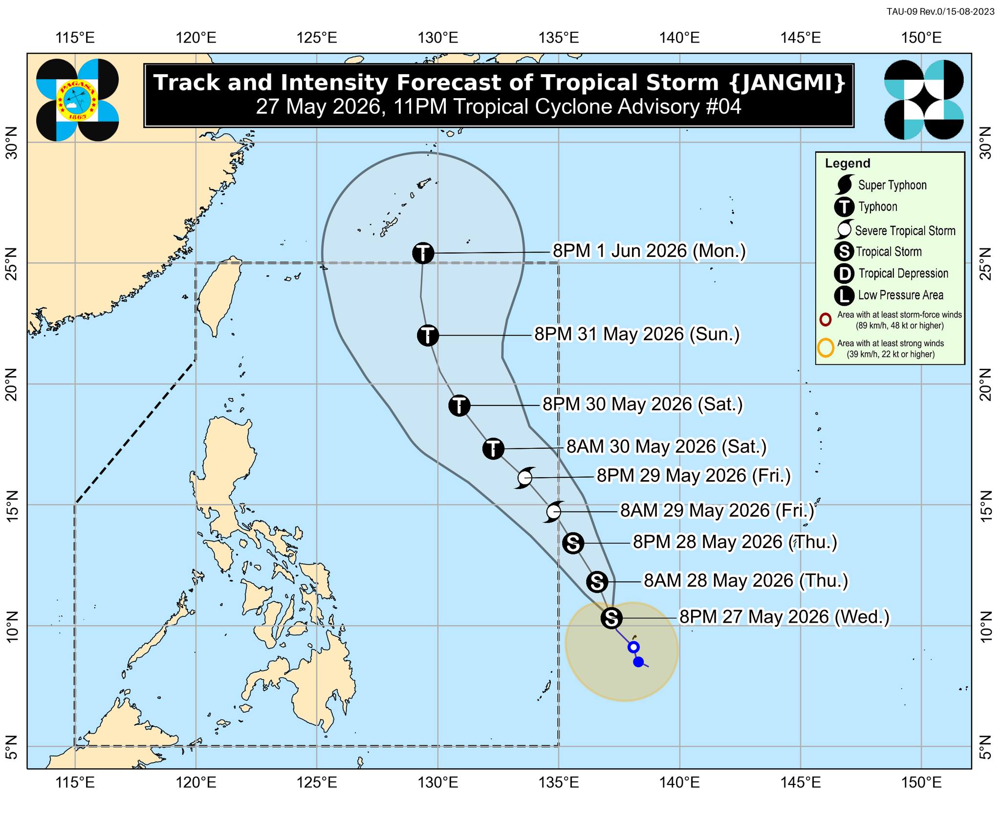
Tropical Storm Jangmi – which is still outside the Philippine area of responsibility (PAR) – has slowed down but maintained its strength, as the state weather bureau added that it is less likely to make landfall over the Philippine landmass.
In its 11 p.m. tropical cyclone advisory on Wednesday night, PAGASA said the center of Jangmi was estimated to be at 1,245 kilometers east of Eastern Visayas as of 10 p.m. of May 27.
It is packing maximum sustained winds of 65 km/h near the center, gustiness of up to 80 km/h, and central pressure of 1000 hPa.
Jamgmi is moving north northwestward at 10 km/h and is expected to continue moving in this direction until it enters the PAR by Thursday evening or morning of Friday, May 29.
It will be designated as Domeng once inside the PAR.
“For the remainder of the forecast period, JANGMI will move generally northwestward to northward while over the Philippine Sea,” PAGASA said.
The tropical storm is expected to continue intensifying and may reach typhoon category on Saturday, May 30.
The state weather said the tropical cyclone may reach its peak intensity between Saturday and Sunday, May 31 while over the Philippine Sea, after which it is expected to steadily weaken.
PAGASA said the tropical storm “is less likely to make landfall over the country.”
“Due to the eastward shift of the latest forecast track, the hoisting of tropical cyclone wind signal over Extreme Northern Luzon is less likely, but not ruled out,” it said.
State meteorologists, however, cautioned against moderate to rough sea conditions over the seaboards of Extreme Northern Luzon this weekend, adding that the imposition of gale warnings over the area is possible.
Jangmi will also likely enhance the southwesterly windflow starting on Saturday. — JMA, GMA News

