

 GMA Brandtalk
 Tracking
 Archives

Jangmi keeps strength as it approaches PH
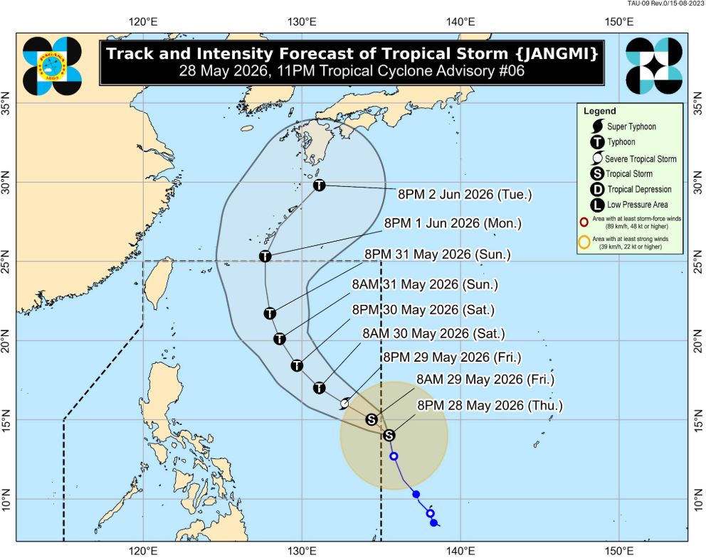
Tropical Storm Jangmi maintained its strength as it moved northward to the Philippines, according to the 11 p.m. tropical cyclone advisory of PAGASA.
Jangmi was at 1,200 km east of Southeastern Luzon, with maximum sustained winds of 75 kilometers per hour and gustiness of up to 90 km/h. It is moving northward at 20 km/h.
PAGASA said the storm is expected to move northward to northwestward and may enter the Philippine Area of Responsibility (PAR) within the next 12 hours.
Once inside the PAR, Jangmi will be given the local name Domeng.
It will then move west northwestward from Friday until Saturday, May 30, before moving generally north northwestward far from Philippine landmass for majority of the remaining forecast period. J
Jangmi is forecast to exit PAR on Monday.
PAGASA said Jangmi will continue to intensify and may reach Typhoon category on Saturday.
"This tropical cyclone may reach its peak intensity between Saturday and Sunday, May 31, while over the Philippine Sea. Afterwards, Jangmi is expected to steadily weaken," it added.
The weather disturbance is less likely to make landfall over the country, added the weather bureau.
"Moderate to rough sea conditions may be experienced over the seaboards of Extreme Northern Luzon this weekend. Raising of gale warning over the area is also possible. This tropical cyclone will likely enhance the southwesterly windflow starting on Saturday," PAGASA said. —LDF, GMA News

